WesternGeco

A Schlumberger company

WesternGeco banner
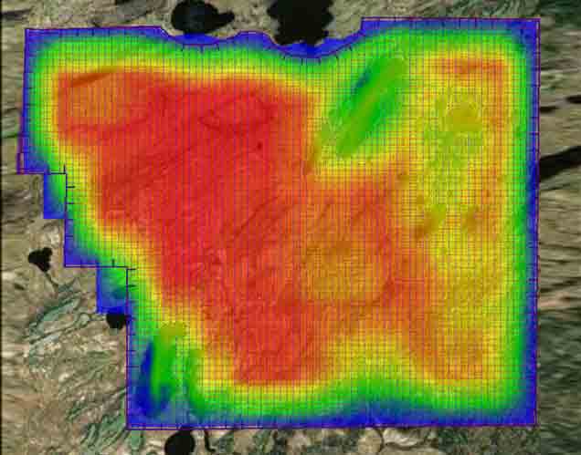
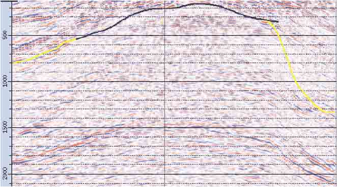
WesternGeco has been a Schlumberger company since 2000. Our clever and dedicated team has the expertise, seismic data, and digital capabilities to help you get to first oil faster and maximize your recoveries. Knowledge and computing capabilities enable us to rapidly evaluate your seismic and multiphysics data and apply precise algorithms that provide you with a high-fidelity image.
WesternGeco logo

Geosolutions software


From survey design and in-field QC to processing, model building, and imaging, we offer a range of software and plug-ins that streamline your processes and enhance your subsurface insights. Most options are now available in the DELFI cognitive E&P environment.


Multiclient services


Our world-leading multiclient data library covers a wide range of basins across the globe, giving you access to mission-critical subsurface insights—and collaborative solutions from our data experts—via a secure portal.


Exploration services


WesternGeco interpretation consultants work with you to develop a custom, integrated geophysical solution—leveraging earth model building and multiphysics approaches—to accelerate your discovery process.

Seismic Services

Seismic and geophysical services for enhanced reservoir characterization and monitoring.

  • The hDVS DAS system acquired VSPs with a strong reflector
    Borehole Seismic
    Wireline-conveyed tools and systems

    Acquire high-resolution seismic images in and beyond the borehole. View

  • Geosolutions software
    Geosolutions Software
    Industry-leading software and plug-ins

    Streamline your geophysical workflows, from seismic acquisition to production optimization. View

  • Multiclient Data Library
    Multiclient Data Library
    Accelerate Hydrocarbon Discovery

    Our world-leading, evergreen multiclient library provides critical subsurface insight to help you make the most informed decisions. View

  • Example of Omni 3D software layout for survey planning.
    Seismic Survey Design & Modeling
    Tailored solutions to your geophysical challenges and objectives

    Address acquisition, data processing, seismic interpretation, and drilling challenges. View

  • Two presenters looking at seismic processing data
    Seismic Data Processing
    Algorithms, services, and workflows that maximize data value

    Address challenges from data calibration and regularization to attenuation. View

  • Conference room discussing seismic imaging
    Seismic Imaging
    Carefully selected, tailored, and applied algorithms

    Ensure image fidelity and confidence in drilling, completion, and production decisions. View

  • Seismic section illustrating the improvements in post-stack depth migration (PSDM) imaging using frequency-domain CSEM.
    Multiphysics
    Subsurface imaging and reservoir characterization studies

    Reduce uncertainty for E&P workflows by integrating seismic and nonseismic data, measurements, and methods. View

  • Group of people discussing seismic data
    Seismic Reservoir Characterization
    Subsurface modeling for optimized operations

    Using the most advanced tools available, we provide consistency between all models and acquisition data. View

  • Seismic Guided Drilling
    Seismic Drilling Solutions
    Create the most accurate earth model

    Address drilling challenges related to wellbore stability and hazard analysis. View