Petrel Combined Core
The power and capabilities required for full exploration and production studies
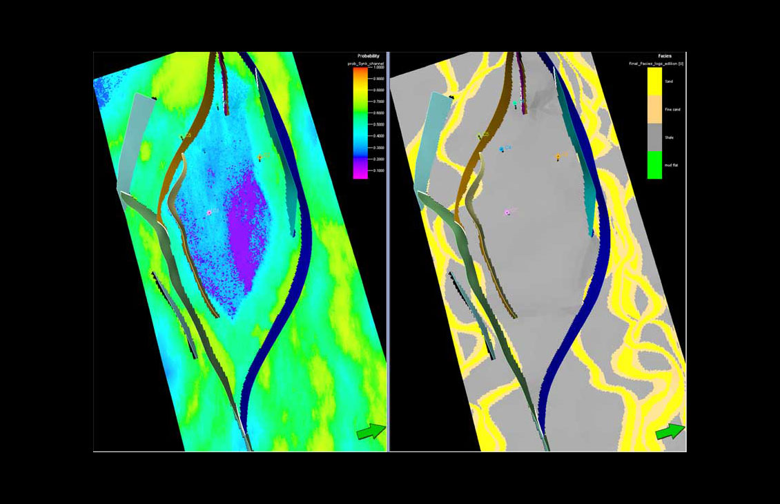
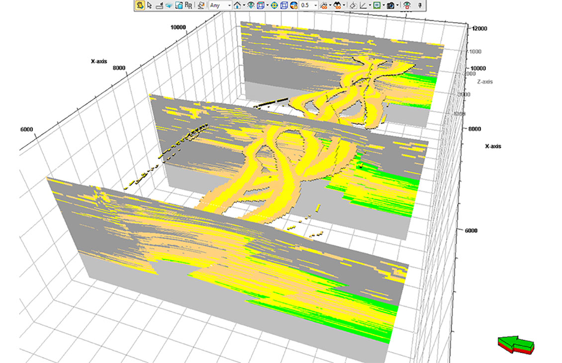
Petrel™ facies modeling is used to populate geocellular grids with discrete property values for geological characterization of the reservoir. It enables both simple and complex workflows—such as seismic-driven modeling in which probabilities can be used in several different ways to help create a realistic representation of the depositional facies or lithologies.
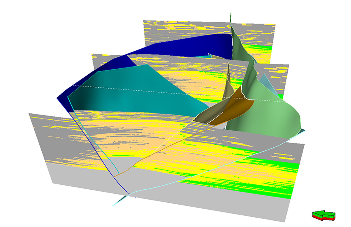
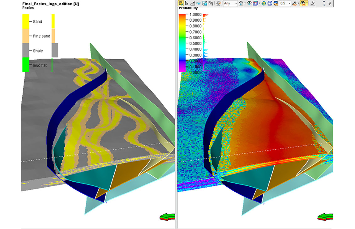
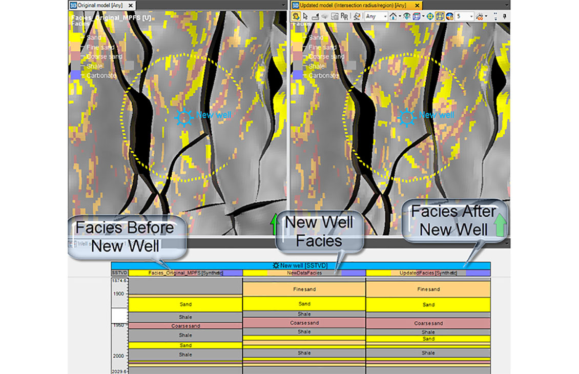

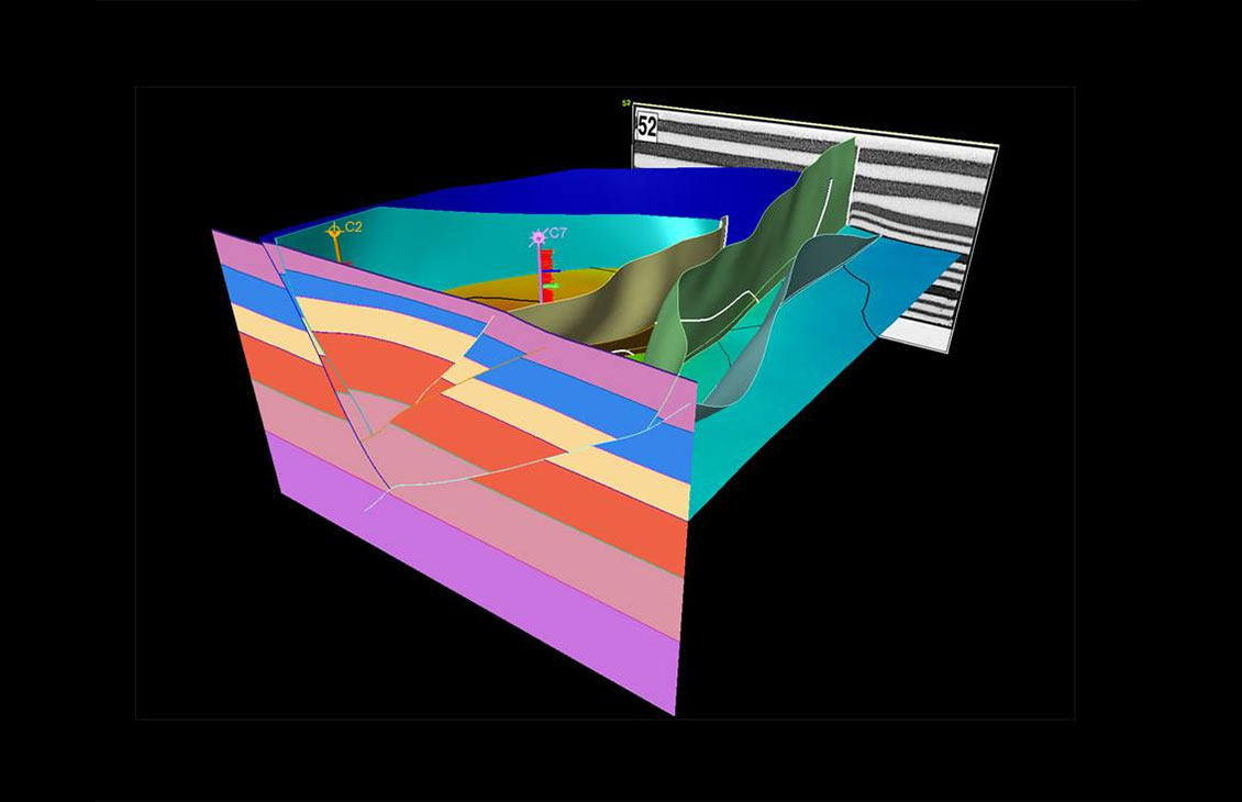
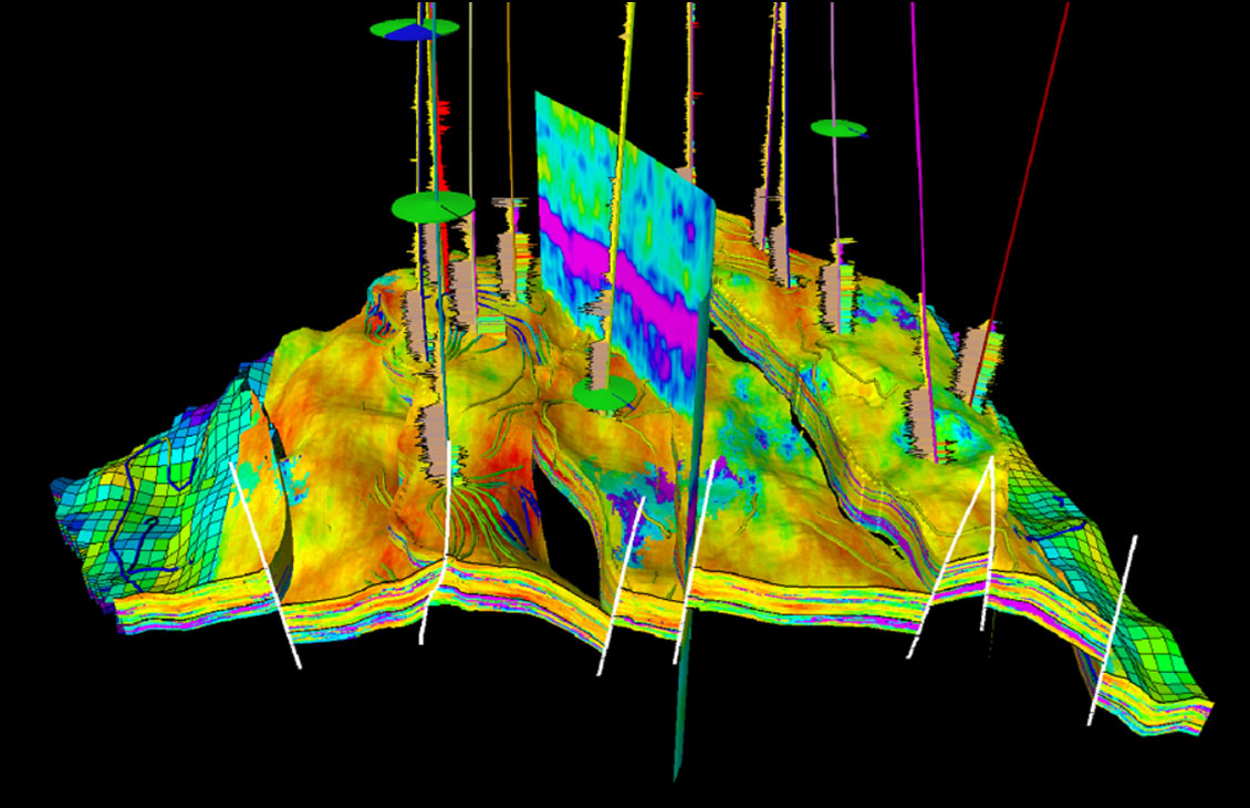
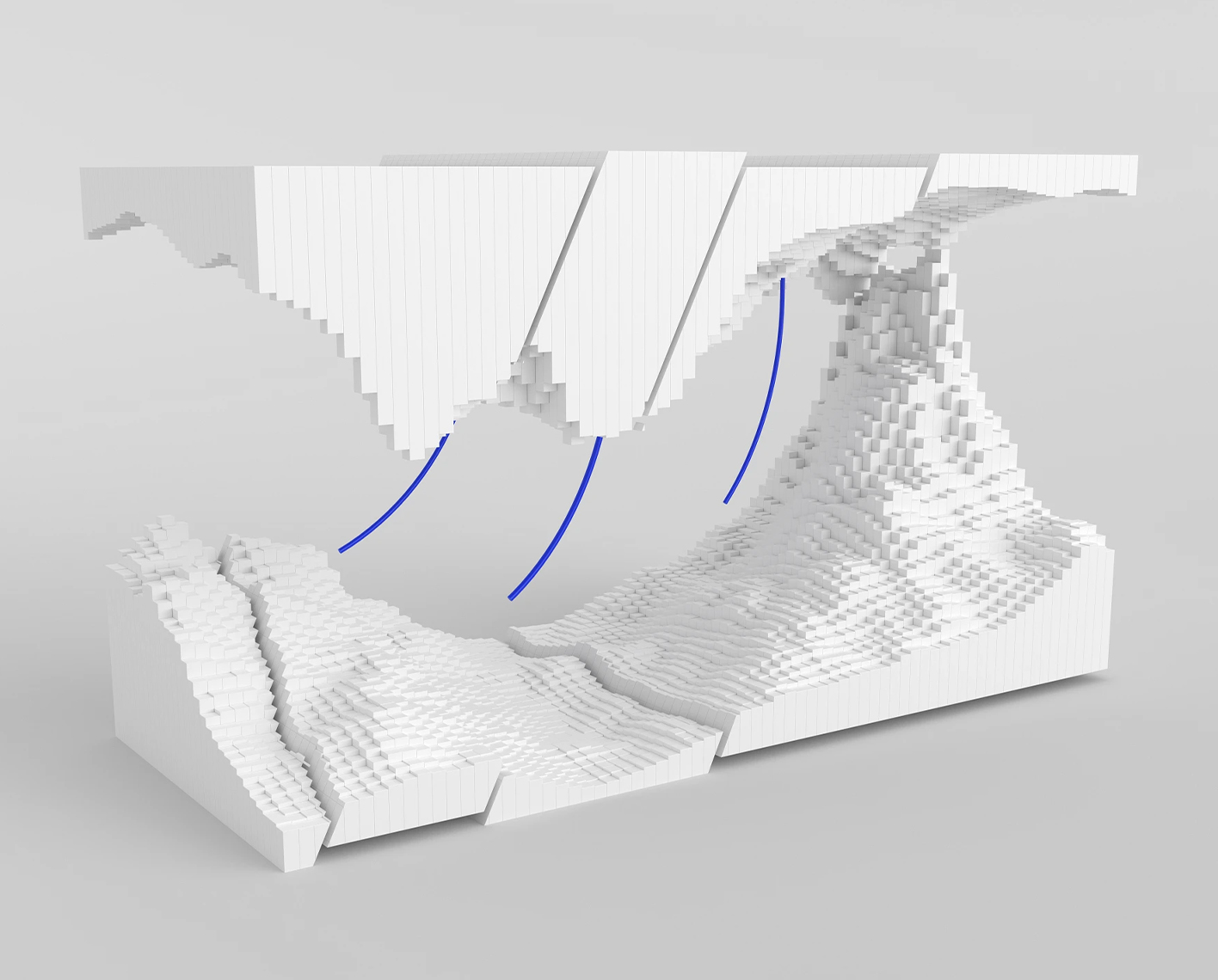
High-resolution well log data and point attribute data can be upscaled into the geocellular grids. Properties are distributed into the remaining 3D grid volume by using a variety of algorithms. Structural grids can model “depositional” properties more accurately using the depospace concept.

NExT training courses address the unique needs of each learner. Our courses, led by distinguished experts in their fields, equip learners with the skills to address practical situations and resolve real-world challenges.
Analyze any data from all angles
Enabling geoscientists to rapidly screen and evaluate basin and petroleum systems using both 1D and 3D modeling.
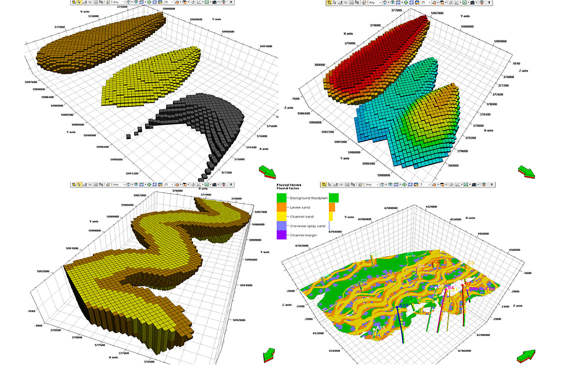
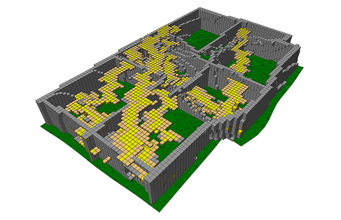
Build accurate facies models
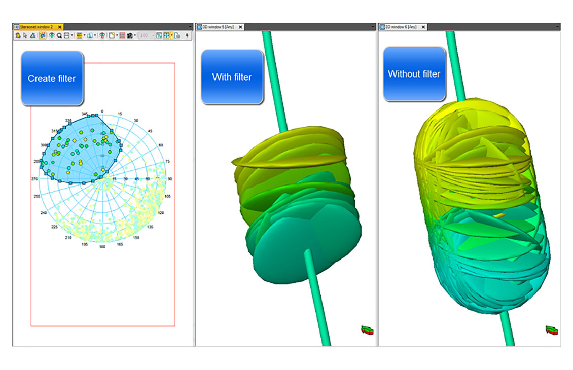
Create geologically consistent fracture models
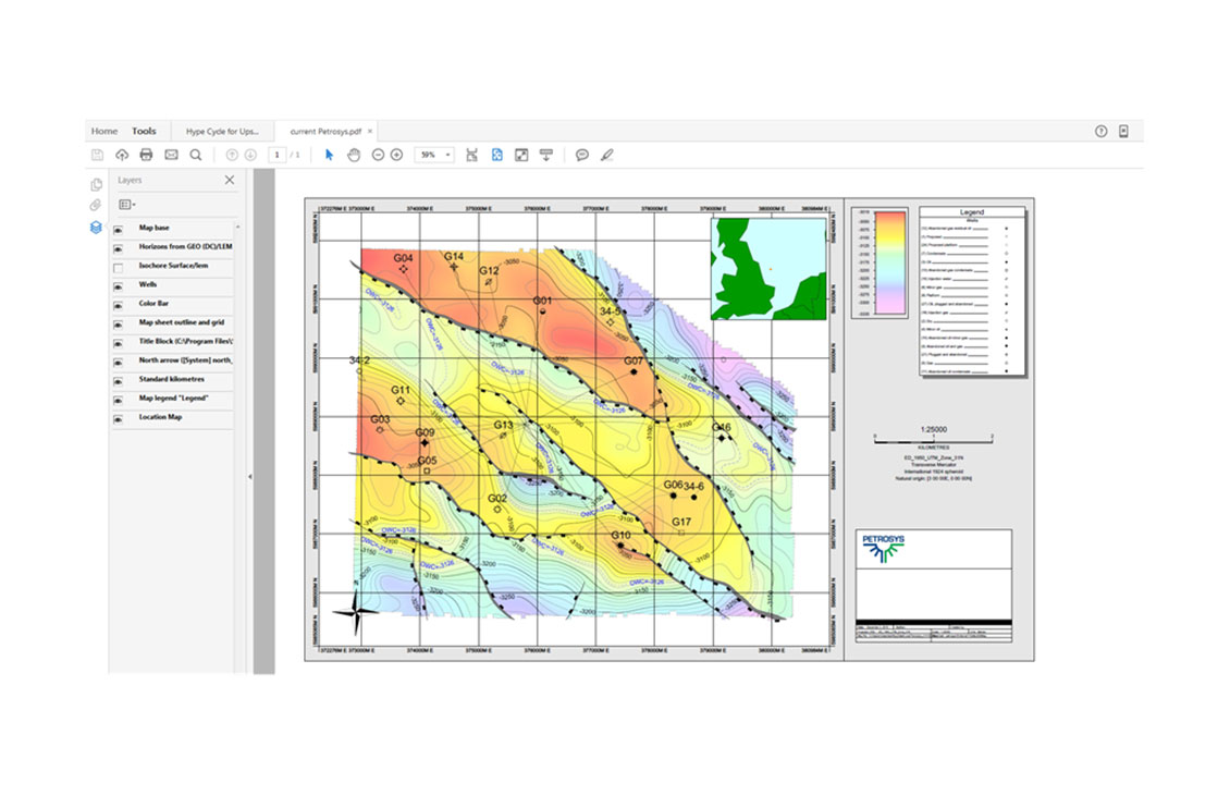
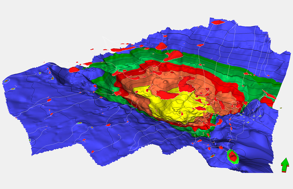
Advanced presentation quality mapping.
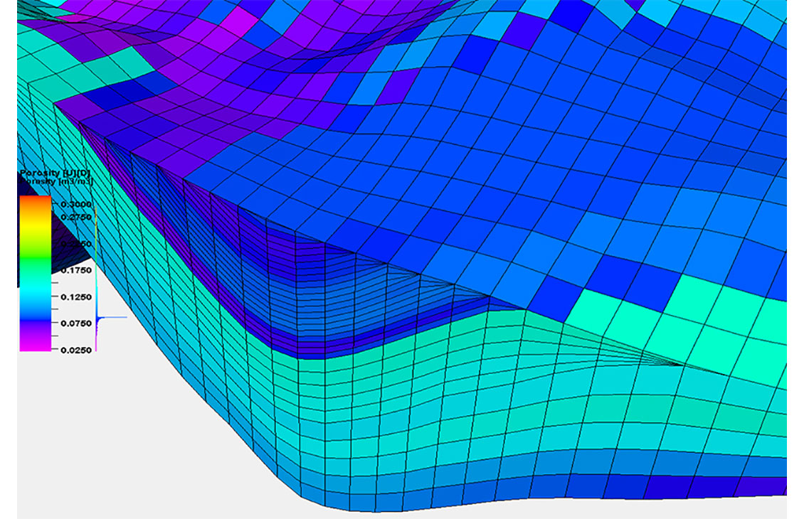
Build accurate petrophysical models
Achieving production objectives with full stochastic evaluation of exploration portfolios
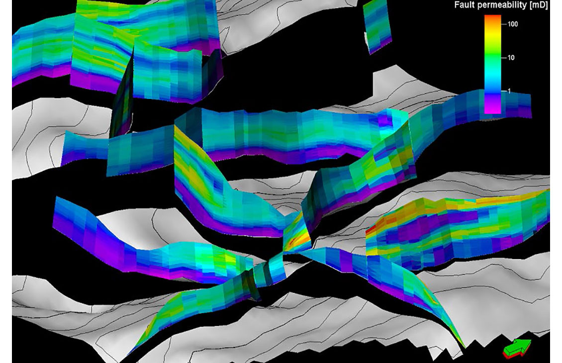
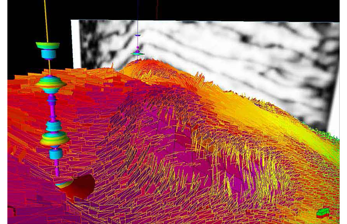
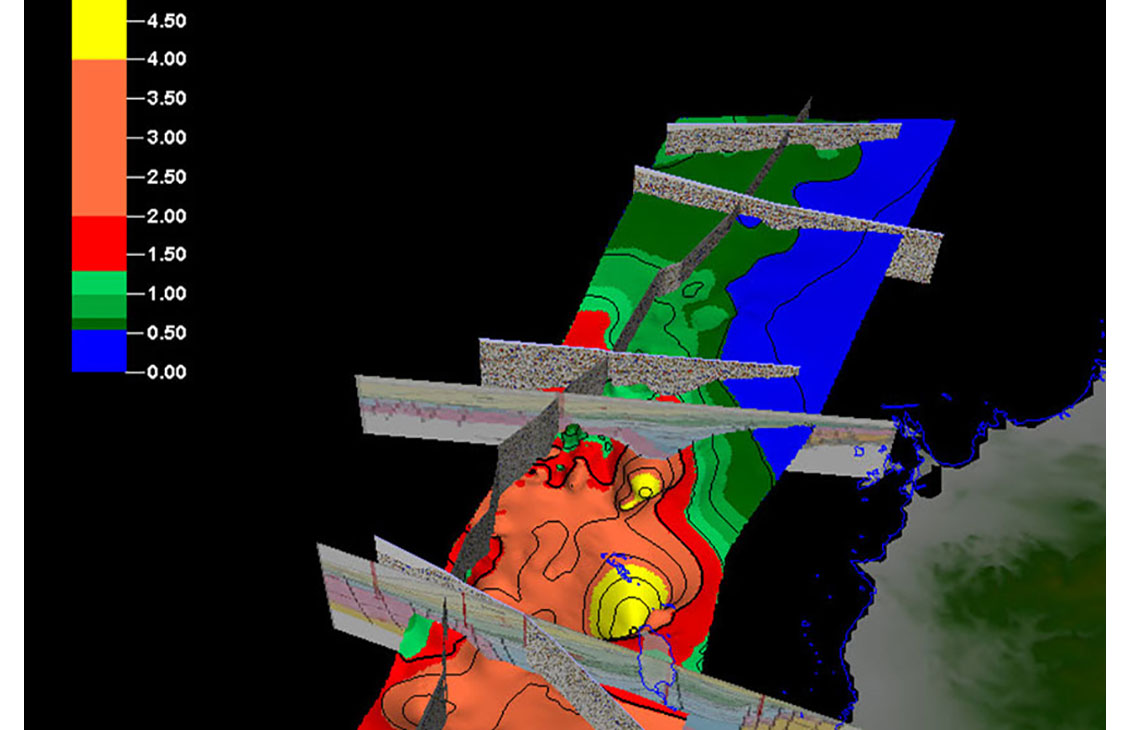
Analysis of fault sealing capabilities and mapping QC tools
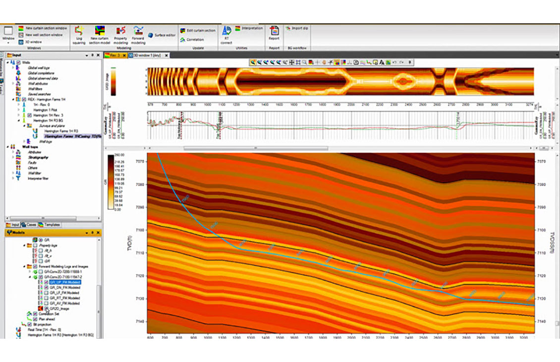
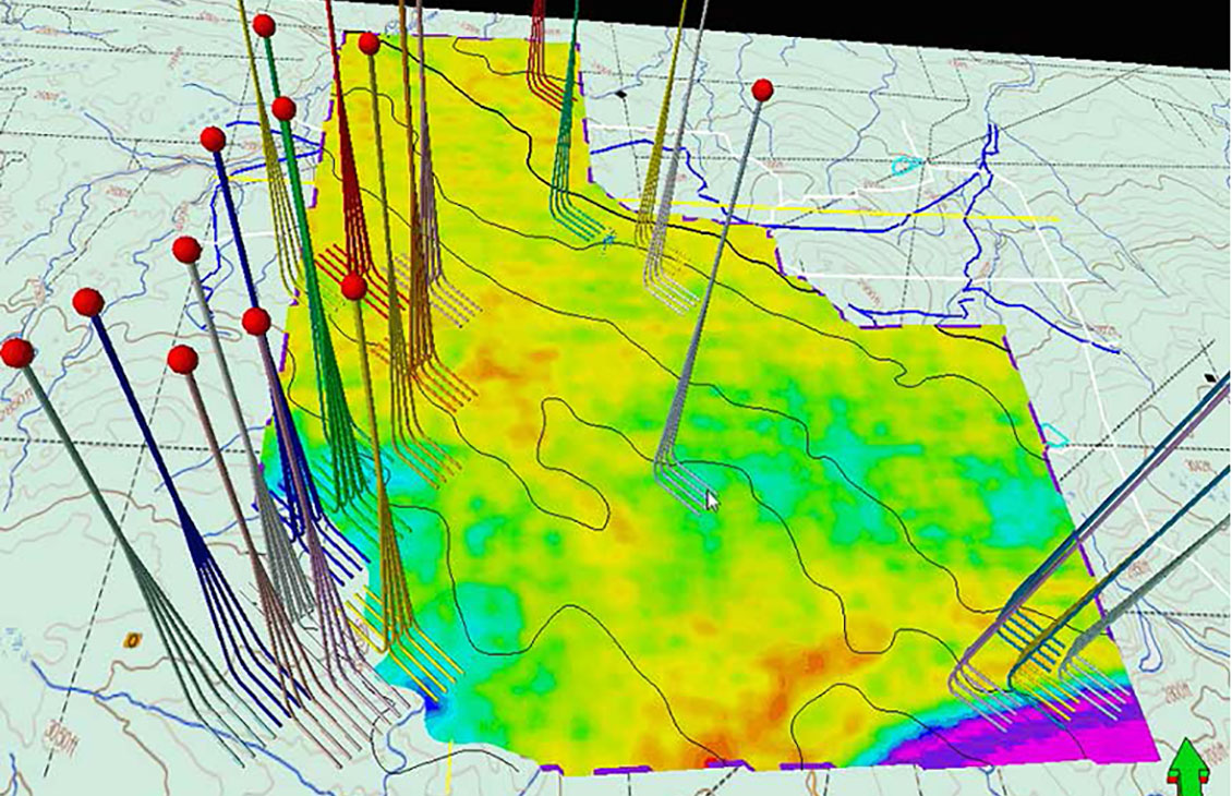
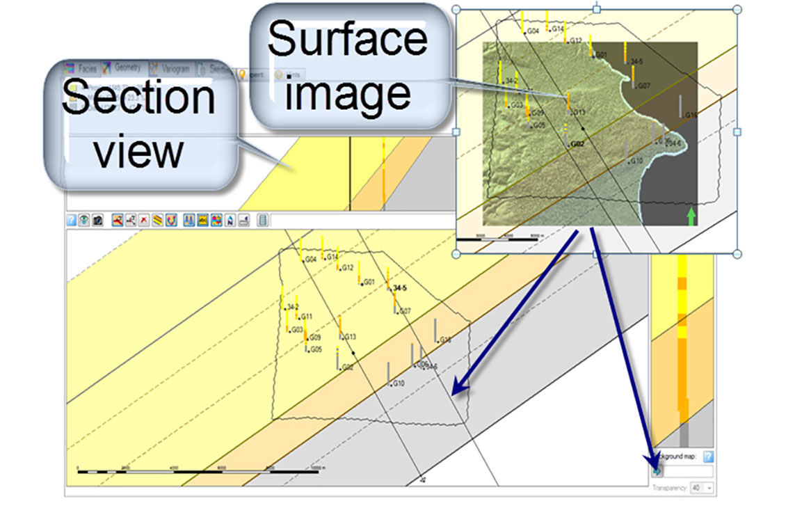
Display, organize, and interpret any type of well data in a flexible 2D environment