Techlog new features
2024.5 Techlog
Techlog AI import tool
Operators often rely on as little as 10% of the available data when making critical investment decisions for exploration or joint ventures.
Techlog AI Import
Operators often rely on as little as 10% of the available data when making critical investment decisions for exploration or joint ventures. Most of the information remains locked in unstructured formats— images, PDFs, or scanned reports.
The new Techlog AI Import tool addresses this challenge by enabling geoscientists to directly import and process unstructured data, including legacy formats such as TIF, LAS, and old images. This capability streamlines data discovery and significantly reduces manual effort. The imported data becomes immediately available for quality control and publication to the OSDU® Data Platform, enhancing overall data accessibility and governance.
Techlog AI Log Prediction
This lightweight, AI-powered log prediction tool is built on a globally trained log foundation model. Developed with curated public data from more than 18,000 wells worldwide, it processes information without the need for a GPU.
Designed to accelerate and enhance subsurface interpretation, the log foundational model provides a strong baseline that users can tune both locally and privately with their own basin or asset data—selecting calibration wells, defining inputs and targets, and running the tuning process directly in Techlog software.
Once customized, the model can predict missing logs across other wells with high accuracy and minimal training data. In the case of acoustic data, many users require shear velocity for diverse workflows—this approach has been shown to reduce the median absolute error in a shear velocity prediction use case by 50% compared to traditional AI methods.
Future releases will extend access to customer-tuned models across other Delfi™ digital platform applications, including Petrel software—enabling seamless, scalable value across the subsurface workflow.
Techlog AI log prediction
AI-powered log prediction tool is built on a globally trained log foundation model.
Techlog AI log prediction
AI-powered log prediction tool is built on a globally trained log foundation model.
Techlog 3DP—Petrophysics for High Angle and Horizontal Wells
This module has long supported correction of log responses for geometry effects, improving accuracy of formation evaluation in high-angle and horizontal wells. Existing capabilities include automatic near-wellbore model initialization using dip sets and density image data.
Optimized for wells with near-parallel trajectory-to-layer intersections, this update strengthens the link between borehole image interpretation and petrophysical analysis.
With this release, users can now automatically initialize local layer geometry using ExpertDip zone images—generated from borehole image interpretations with Techlog’s ExpertDip plug-in.
This enhancement enables:
- Seamless integration of geological interpretation into petrophysical modeling.
- Streamlined model setup for high-angle and horizontal wells.
- More accurate and efficient multi-layer formation evaluation.
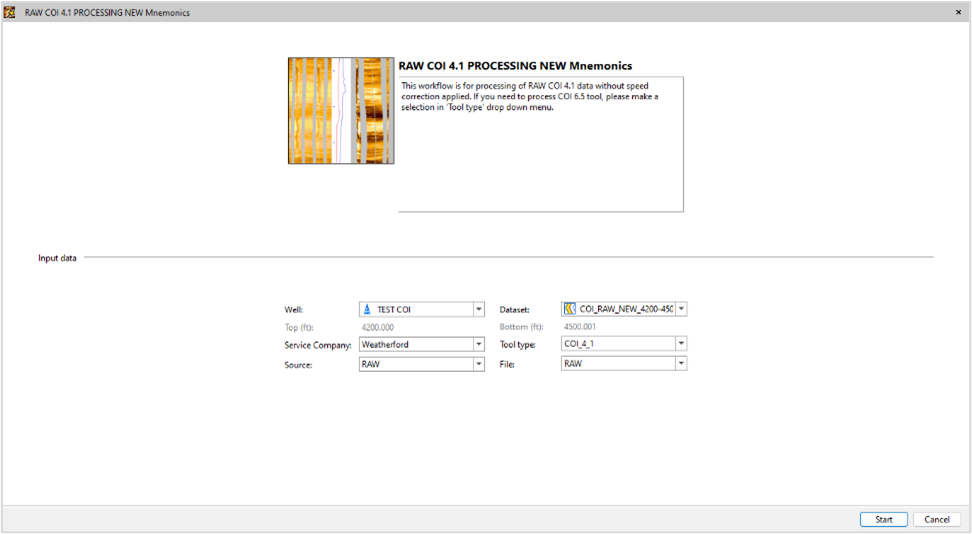
Techlog Wellbore Imaging (Wbi)—borehole image processing of COI 4-1 Weatherford™
The new image processing wizard in Techlog software now supports the COI 4-1 Weatherford™ tool, which previously couldn't be processed alongside other tools and providers. This enhancement enables users to process a wider range of borehole images within Techlog software, regardless of the data source.
2024.3 Techlog
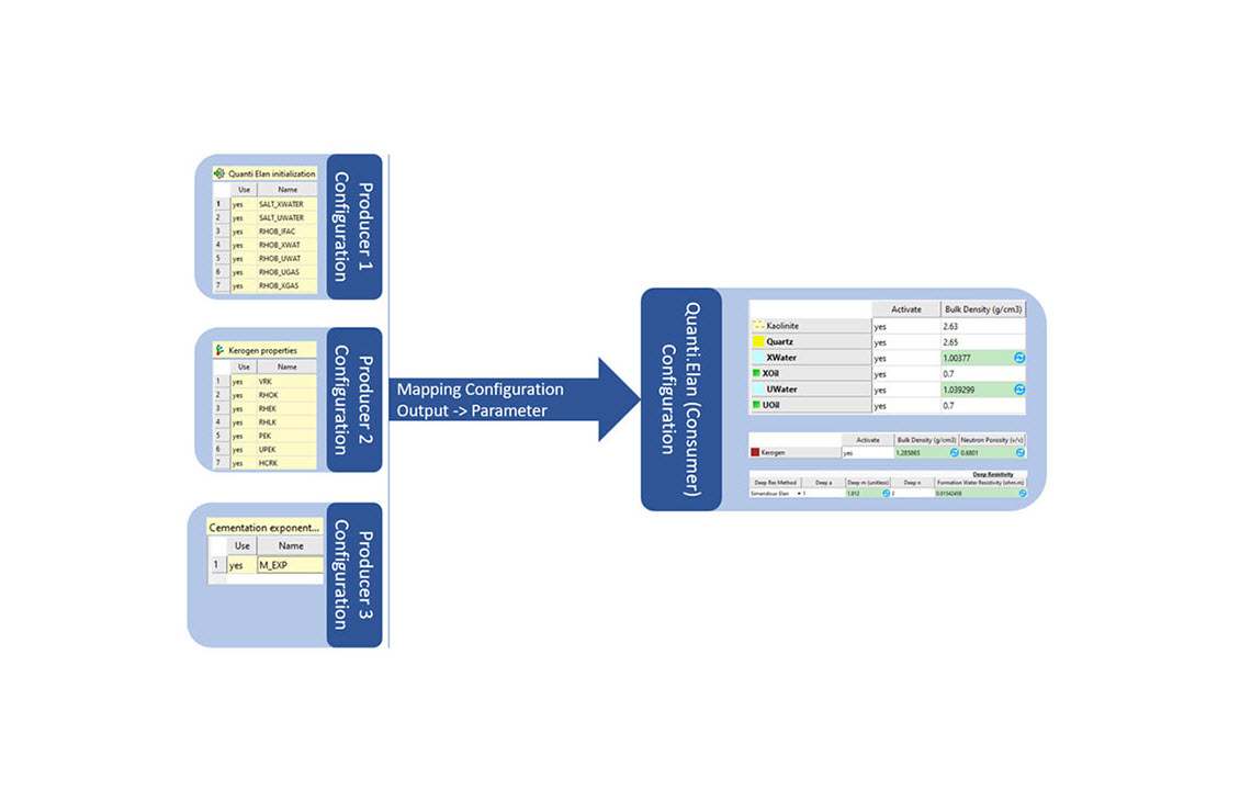
Quanti.Elan
With the introduction of new Python APIs, you can now define a variable, generated by a specified method, to serve as a substitute for an equivalent Quanti.Elan initializations output.
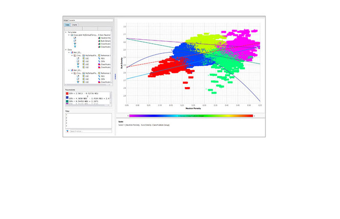
Cross-plot
The new cross-plot option has improved data loading performance, graphical performance, plot handling of datasets and data points, and increased equation saving formats.
Python
Update of Python version to 3.12 to ensure a more secure and upgraded version, better performance of several modules, and binder APIs to help connect output of the application workflows interface.
Power BI connector for Studio E&P knowledge software and Techlog software
The Power BI connector has been updated to retrieve information related to Studio software and Techlog software entities.
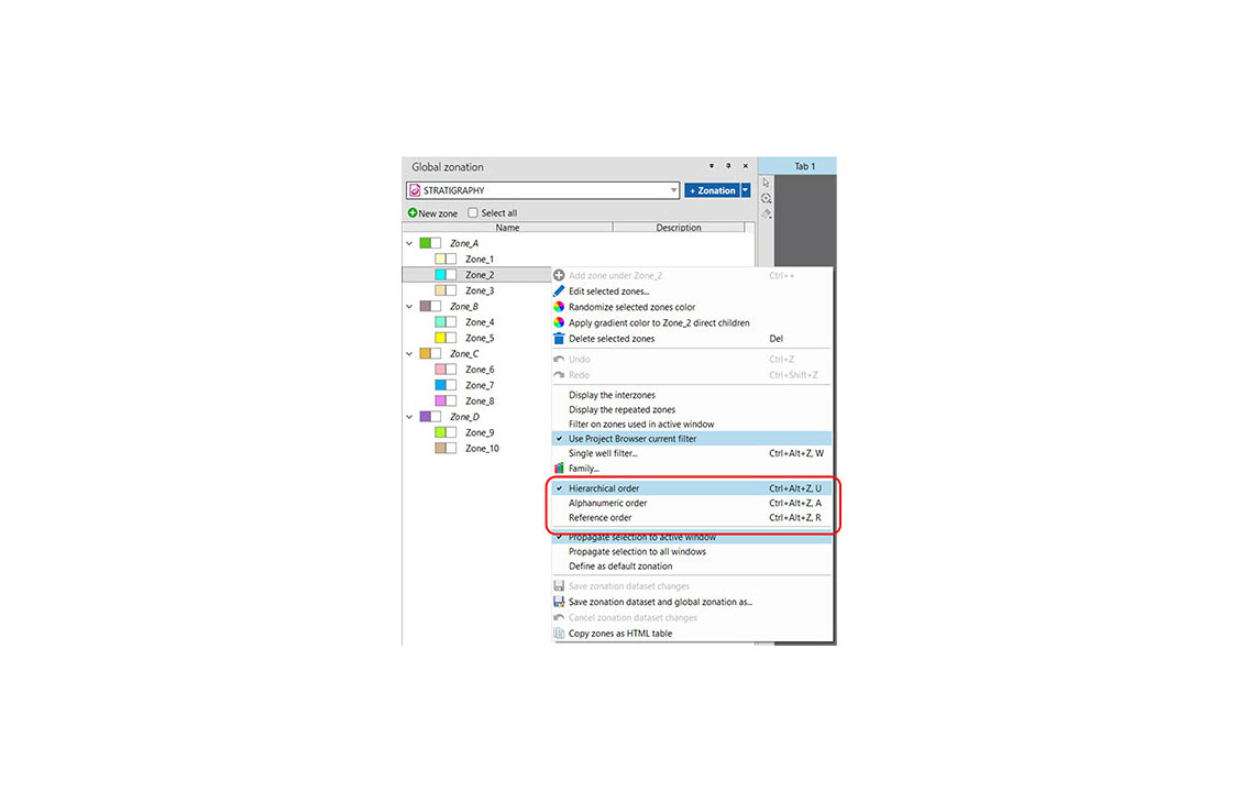
Zonation
The zone list order is now kept as a Techlog software setting on your computer.
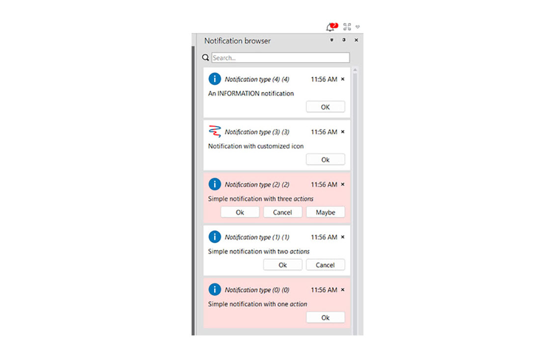
Notification center
Integrate the notification browser into a dock window to centralize the display of notifications from various plugins.
2023
2023 Techlog new features
Python updates
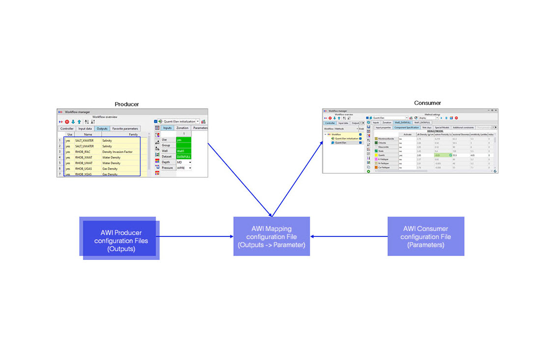
New Python application programming interface (API) and bug fixes.- Using the Python API, you can now access, manipulate, and get information about the different components of the application workflow interface (AWI) or any Python AWI
- Bug fixes and stabilization of Python APIs
- Python Editor update: there is now more space in the coding area. You can collapse any unused parameter definition, description, and output sections
Usability improvements
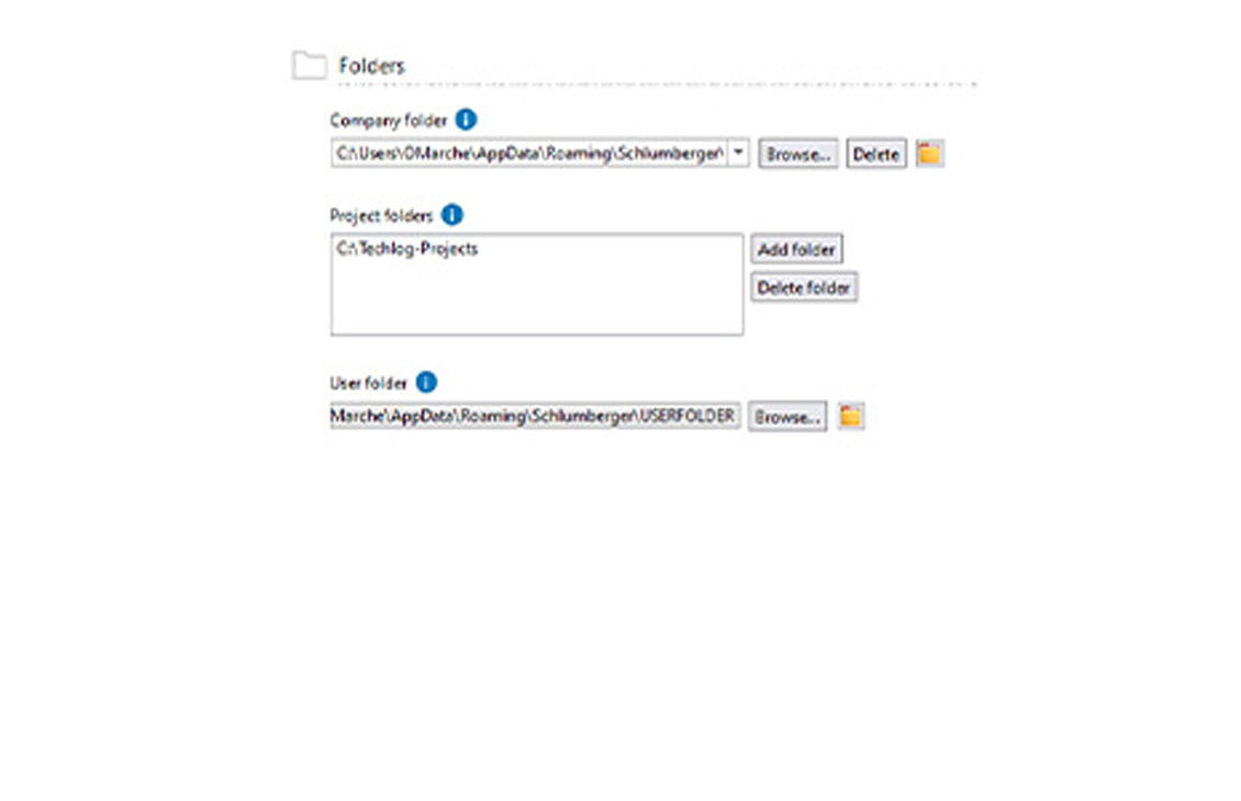
Shortcuts in few key places to reach folders in windows explorer faster
- A new button enabling you to access the user and company folders from the Techlog wellbore software platform has been added to the folders dialog box
- Additionally, an option to open log files directly from the output window has been added
Zonation updates
Work on user experience improvement continues.
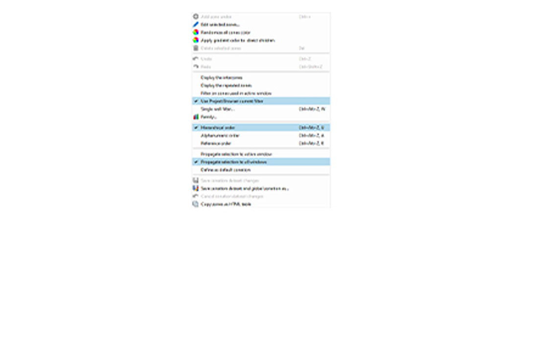
- You can now filter global zonation based on the filter in the project browser
- The global zonation selection is not lost when you click an empty space in the dock window
- There have been improvements made to the graphical editing zones of LogView when using the extend option and multiple zonation tracks
- There have been bug fixes to zonation to make it more stable and increase performance
Unconventional reservoir petrophysics
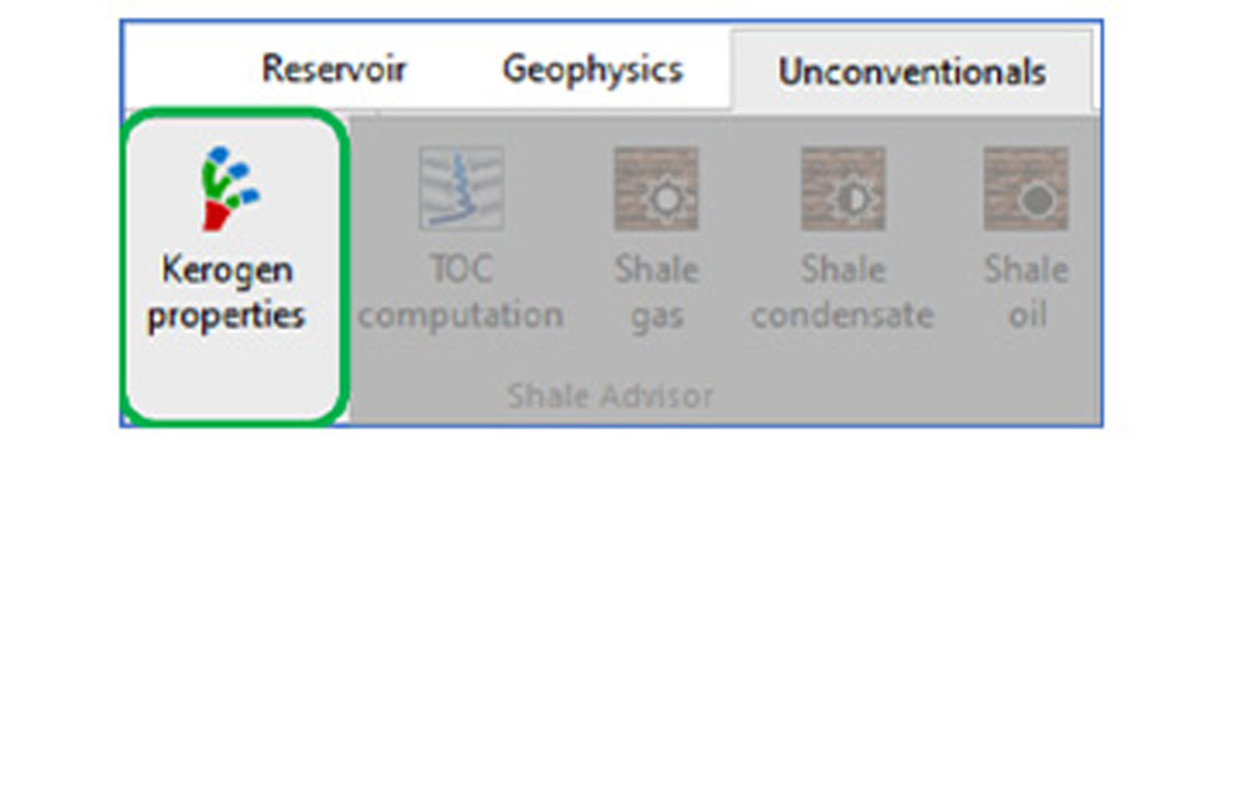
Kerogen properties
You can now compute a consistent set of kerogen properties from a single estimate of thermal maturity. The outputs are primarily used as end points in Quanti.Elan. This new method enables thermal maturity adjusted log interpretation (TMALI) in unconventional reservoirs; and helps to perform more accurate and confident interpretation of porosity, saturation, and hydrocarbon in place in organic-rich shales.
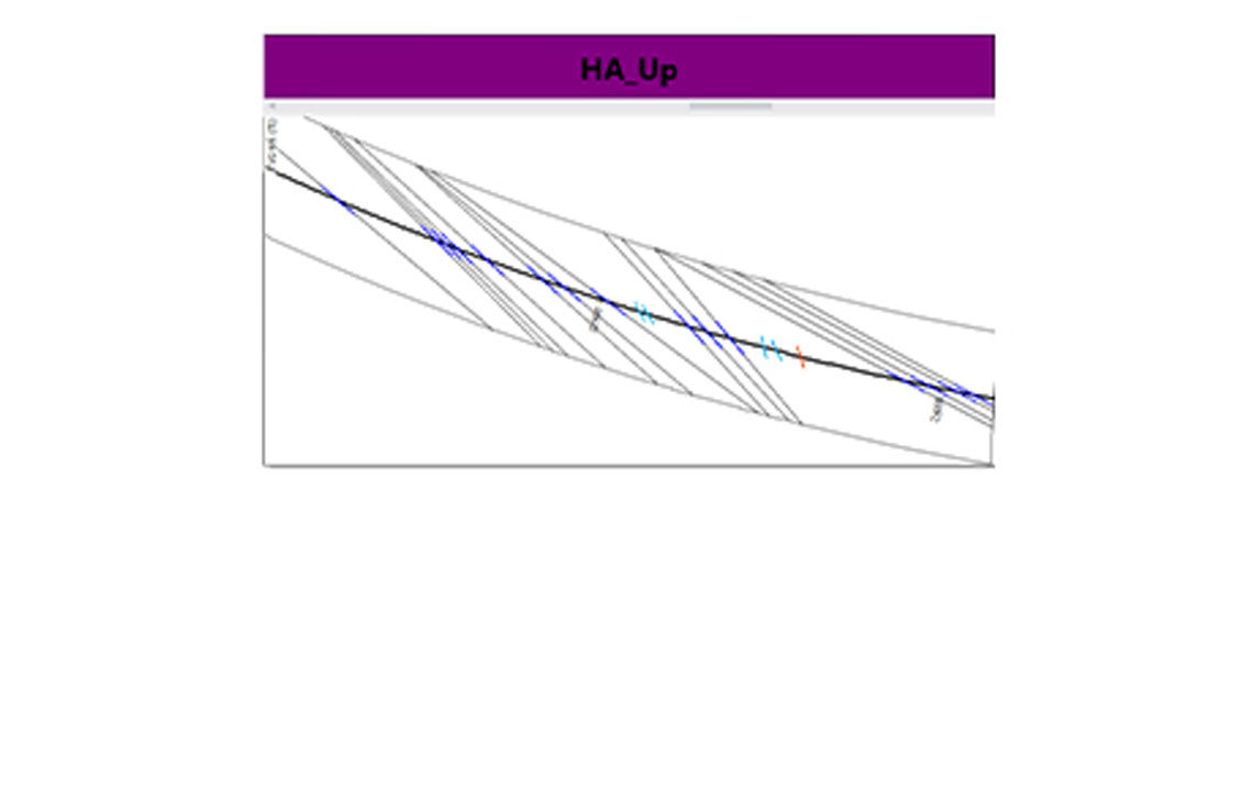
3D petrophysics for high angle well evaluation
Initialize local layer geometry from dip set.
You are now able to initialize local layer model geometry from dips, through an automatic workflow. This expands the local layer model initialization workflow from LWD images to any dip set.
3D petrophysics
Pixel inversion processing (PIPER) upgrades.
PIPER now offers the following functionalities:
- Support of input variables with suffixes (_EC and _RT)
- Filter input variable dip according to classifications
- Graphical selection of processing interval
Thin bed analysis - Low resistivity pay
LowReP develop end points method enhancements.
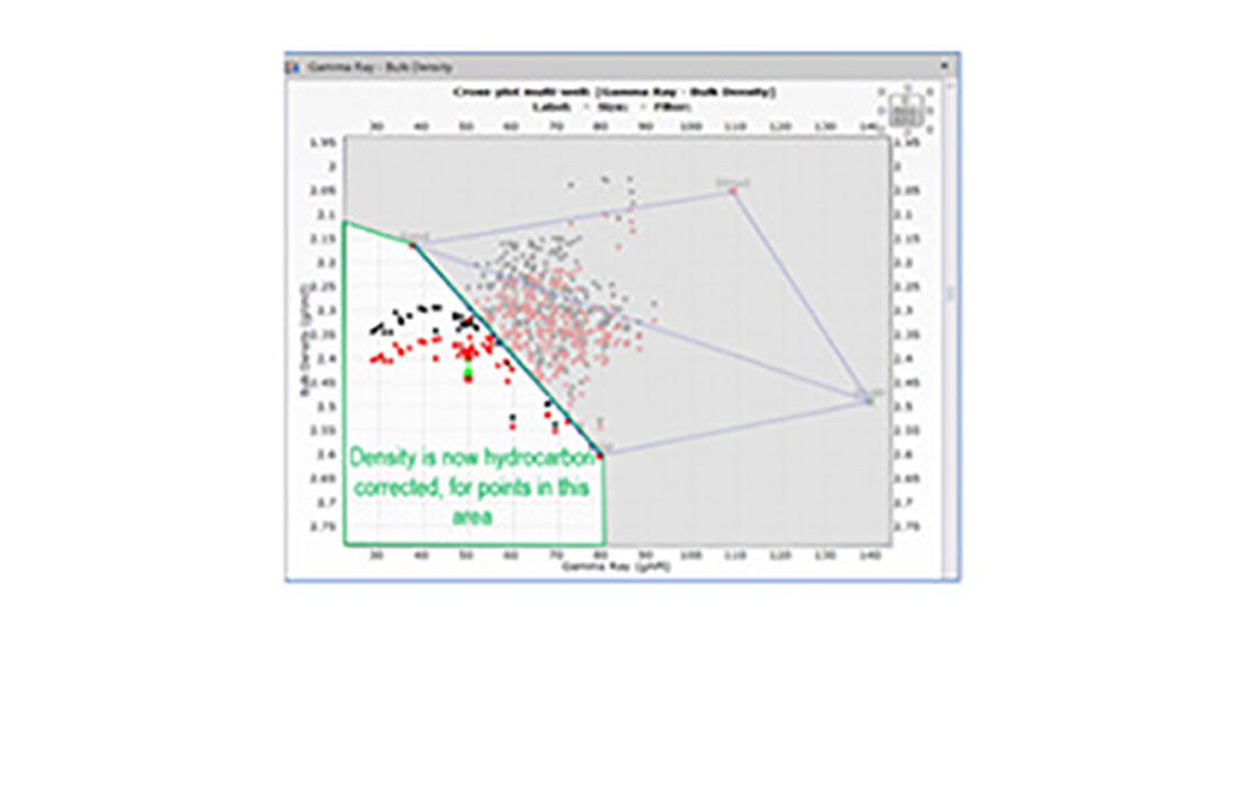
Updated hydrocarbon correction logic for density-GR plot.
Hydrocarbon correction is now applied to density for the input points located at the left side of sand-dispersed shale line in density-GR cross plot.
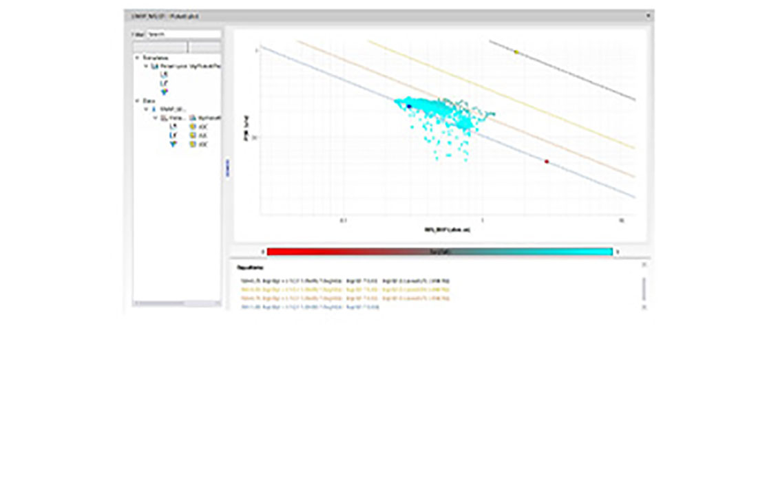
Pickett plot—technology preview
Improvement of the Pickett plot
You are now able to use a third curve to color the Pickett plot.
In addition, the water saturation (SW) lines can be hidden by double click on the equations in the plot.