Petrel Seismic Survey Design Plug-In
Seismic survey design and analysis
Seismic survey design and analysis

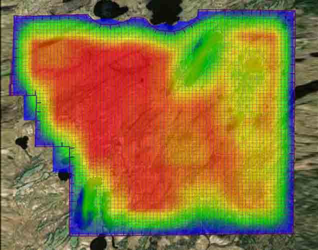
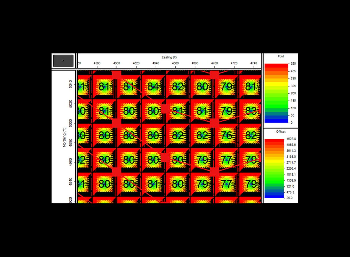
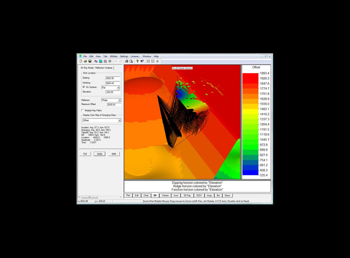
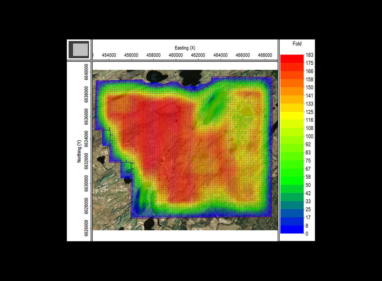
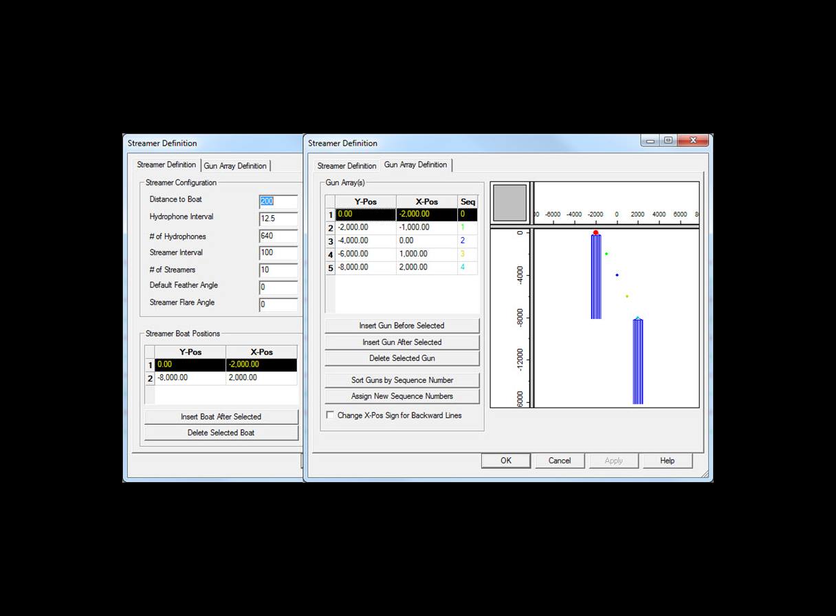
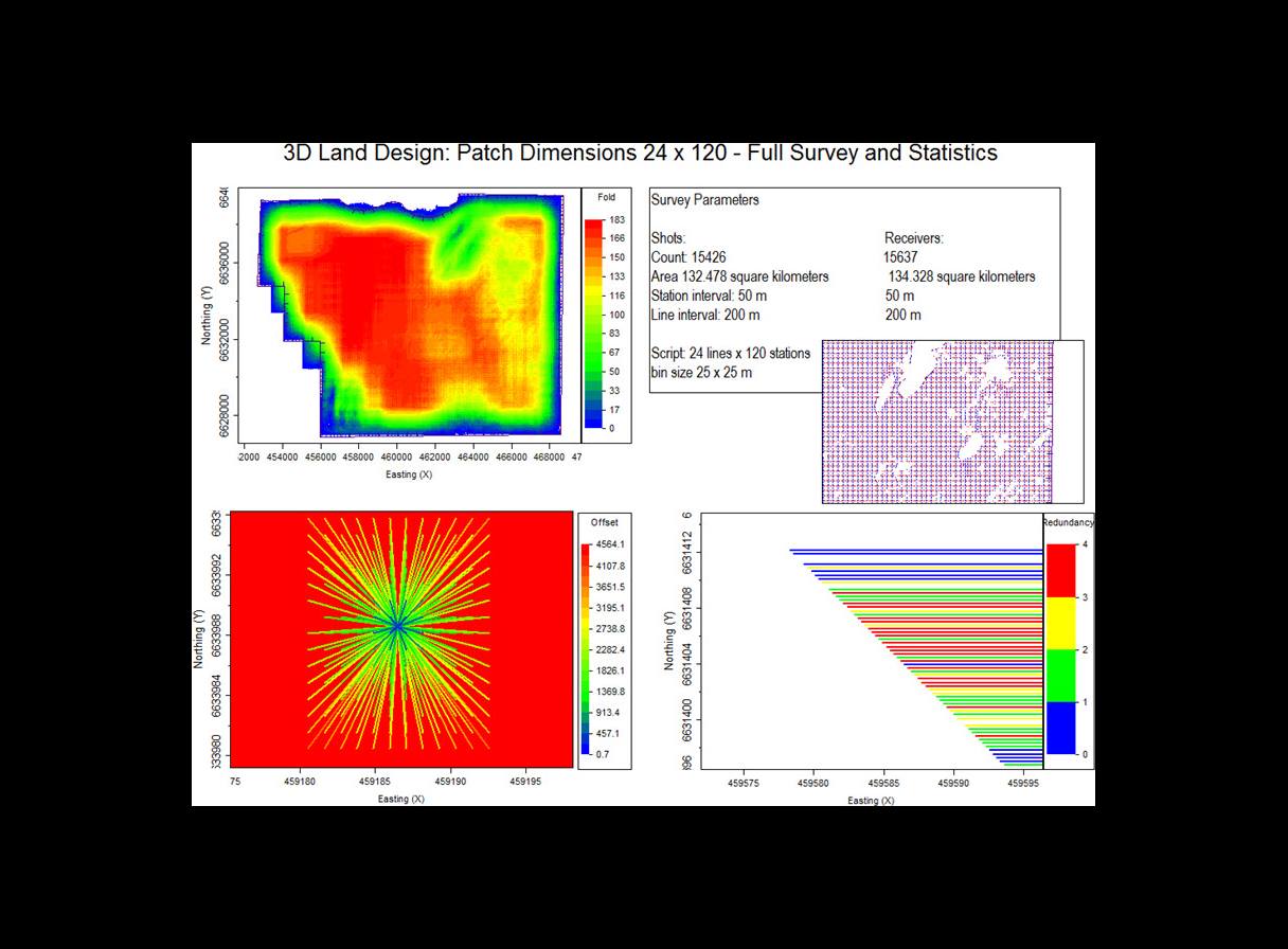
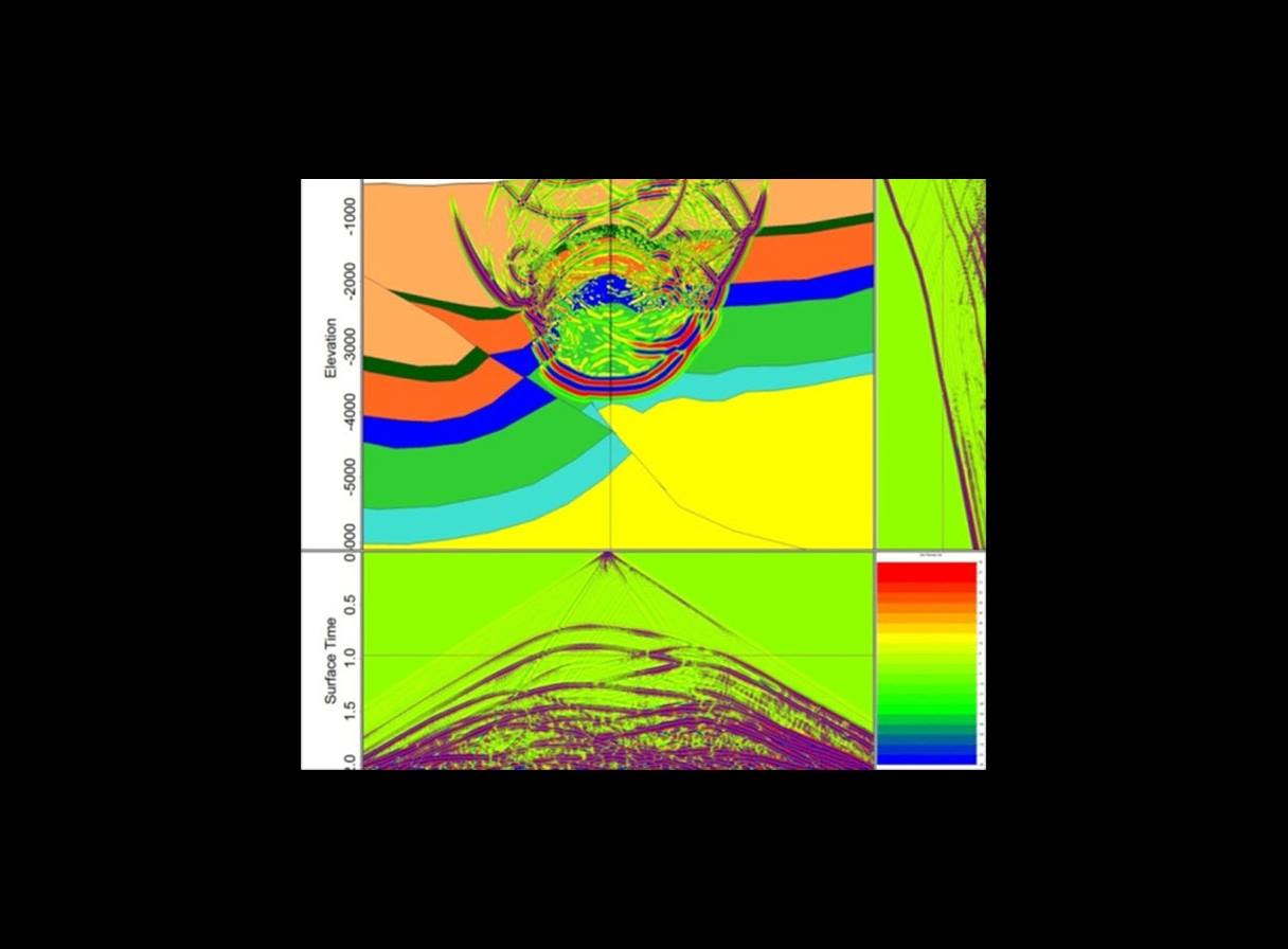
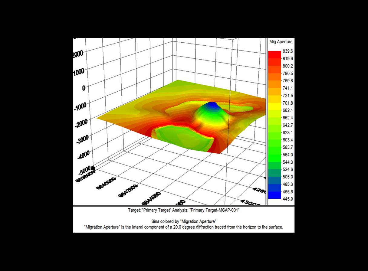
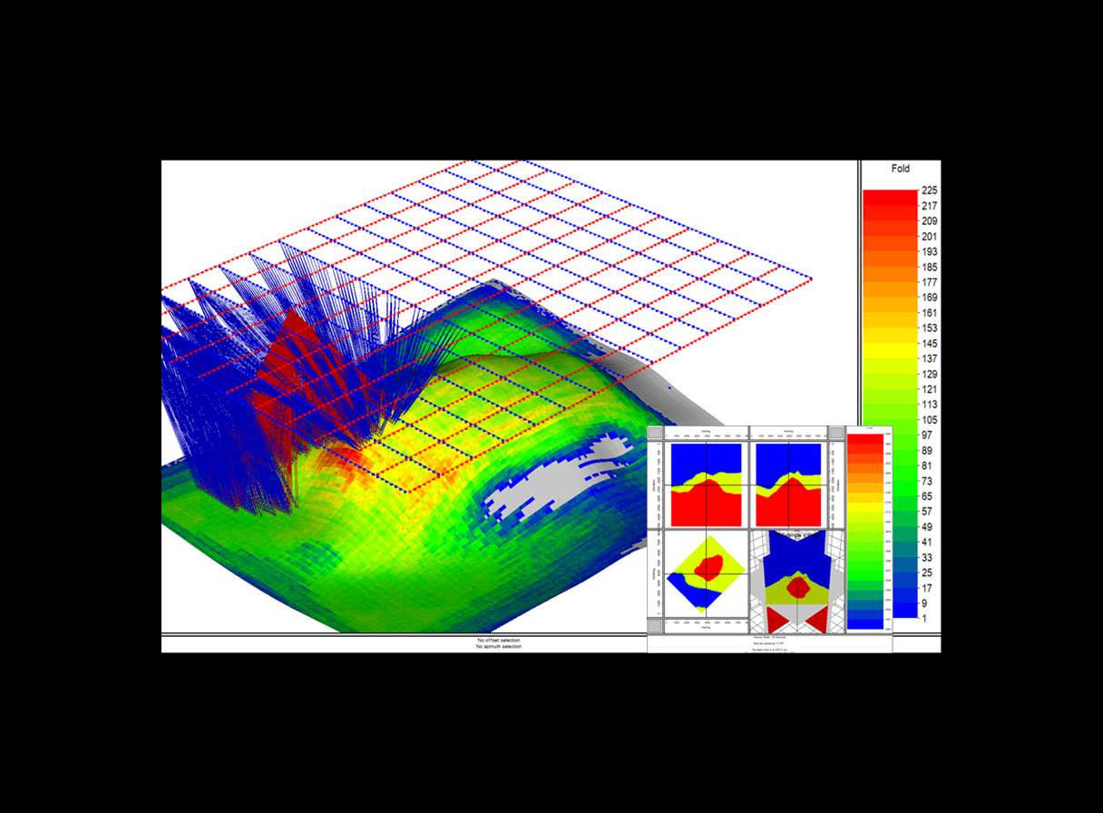
Omni 3D seismic survey design software helps you create optimal 2D and 3D designs for land, marine, ocean-bottom cable (OBC), transition zone, vertical seismic profile (VSP), and multicomponent surveys. Advanced analysis modules in the software enable you to examine geometry effects, analyze geometry artifacts, generate synthetics, and build and ray trace 2D and 3D geological models.
With its sophisticated tools, an easy-to-use interface, and versatile multiproject handling, OMNI 3D software helps bridge the gap between E&P asset and acquisition teams. These features make OMNI 3D software the industry standard for geoscientists involved in survey planning, design, QC, and modeling worldwide.
The software is available in two packages:
A set of essential tools for acquisition, design, editing, and monitoring.
A comprehensive set of tools for geometry building, editing, and QC as well as advanced analysis in the time or depth domain.
Omni 3D 2024 release announcement
Omni 3D software is the industry standard for seismic survey design and modeling. It can be used to plan, execute, and analyze land, marine, transition zone, vertical seismic profile (VSP), and multicomponent surveys. The intuitive interface and versatile multi-project handling capability of the software enable users to analyze and monitor their seismic acquisition projects quickly and effectively. Omni 3D 2024 improves the user experience with a focus on usability and efficiency, with a faster turnaround on common workflows.
Omni 3D software is available in two modules:
Omni training courses address the unique need of each learner, our courses, delivered by world-class experts, teach learners how to deal with real-life scenarios and solve genuine problems.