Accelerating seismic interpretation in the Kwanza Basin with machine learning
As part of the OneKwanza Merge seismic reimagining project SLB used machine learning (ML) to accelerate regional exploration in the offshore Kwanza Basin. This project demonstrated that by leveraging ML technology it is possible to significantly improve the efficiency and quality of seismic interpretations.
The ML-assisted method accelerated seismic interpretation by three to ten times on each of the horizons needed for regional exploration, resulting in quicker, more accurate, and precise tracking of geological events. This enabled better analysis of exploration prospects and risk qualification.
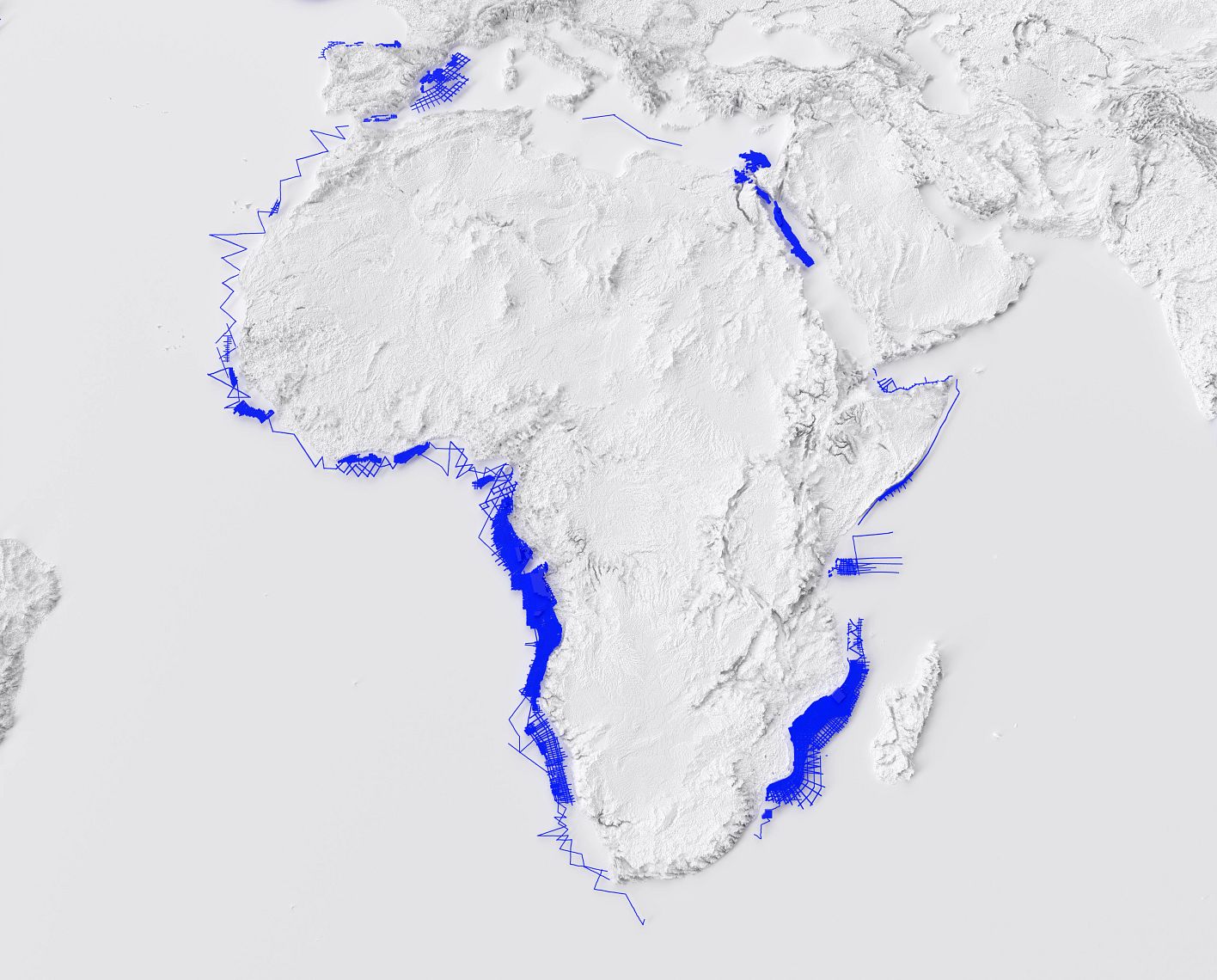
Regional interpretation of a massive Kwanza Basin dataset was required. Previously, manual interpretation was tedious, slow, and required many interpreters. This process was not only time-consuming but also prone to inconsistencies and inefficiencies, making it difficult to achieve the desired speed, precision, and accuracy in seismic interpretation. Therefore, the primary objective of the project was to interpret seismic data efficiently and accurately for regional exploration. The focus was on better understanding the subsurface geology and identifying potential exploration prospects.
Additionally, the project aimed to expedite the seismic interpretation process, so that more time could be spent evaluating data, better analyzing exploration prospects, and better qualifying the risks involved with each of these prospects. This project also supported holistic basin-wide prospect play reviews.
The solution was delivered by integrating machine learning technology within a high-performance computing (HPC) platform, to accelerate the interpretation process and provide consistent, high-quality results for high resolution projects at a regional scale.
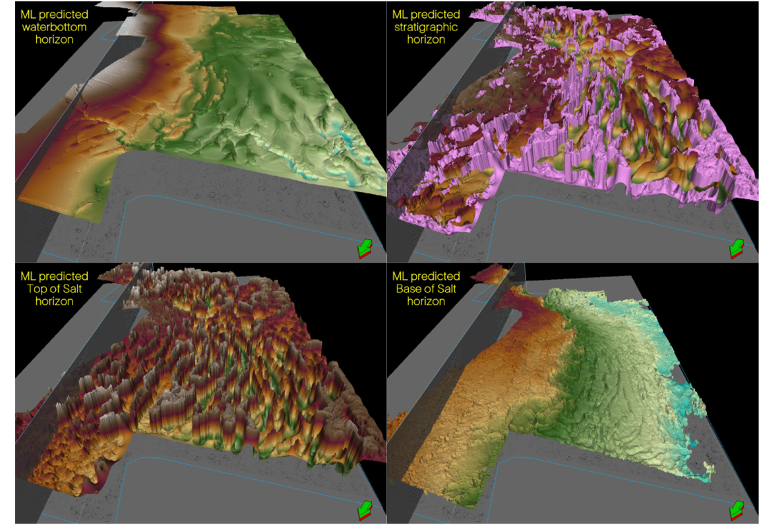
Convolutional neural networks (CNNs) were developed, by expert interpreters from SLB, using extensive survey-tailored training label datasets, consistent with high-quality seismic volumes from the SLB multiclient data library. These CNNs are designed for production work at various scales, from local to regional. They are trained with high-resolution datasets, incorporating historical learnings from interpretations, models, and images from the SLB multiclient data library, together with the augmentation by technologists who helped formulate the migration codes. This ensures that the predicted results are appropriate for model building and exploration studies.
Pre-trained CNNs were used to predict the water bottom and top of salt (TOS) horizons, while user-trained CNNs were utilized for the base of salt (BOS) and stratigraphic horizons. These pre-trained CNNs enabled further customization. By fine-tuning the data and transferring learnings from the CNNs, the team were able to leverage models trained in one part of the study area to make predictions for other areas with similar geological settings. This significantly reduced the need for extensive manual labelling and training. By applying this approach, they extended predictions from the western part of the Kwanza Basin dataset to the eastern part, ensuring consistency and reducing the time required for interpretation.
The implementation of this machine learning (ML)-powered solution has significantly accelerated seismic interpretation processes. Previously, manual interpretation of the water bottom (WB) took 80 hours, with ML assistance, this task is now completed in just 8 hours, representing a tenfold increase in efficiency. Similarly, the interpretation time for the top of salt (TOS) has been reduced from 400 hours to 144 hours, and the bottom of salt (BOS) interpretation has decreased from 320 hours to just 100 hours, achieving a 3.2-fold improvement. For stratigraphic horizons, the manual interpretation would have taken 400 hours, whereas with ML assistance, it was completed in just 120 hours, marking a threefold efficiency gain. These advancements facilitate more efficient and thorough analysis of exploration prospects and risk qualification.
Related resources
-

Living Digital Series
Transforming the energy industry performance and driving decision making at speedBrilliant minds from upstream oil and gas share their experiences and discuss project successes using digital solutions to solve everyday challenges.
-

Multiclient data
Accelerate hydrocarbon discoveryOur world-leading, evergreen multiclient library provides critical subsurface insight to help you make the most informed decisions.
-
Living Digital: Accelerating regional exploration with machine learning for offshore Kwanza
The interpretation of horizons is one of the most tedious tasks in regional exploration studies—but it doesn’t need to beThe interpretation of horizons is one of the most tedious tasks in regional exploration studies—but it doesn’t need to be.