AlphaSight service—which uses a novel LWD platform based on triaxial, collocated antennas providing a multidepth azimuthal resistivity (MDAR) architecture—was deployed in the field. This platform integrates shallow, medium, deep, and ultradeep resistivity measurements, with a deep transmitter positioned just 7 ft behind the bit and fully integrated with the rotary steerable system. The service includes advanced inversion workflows and 3D reservoir mapping outputs, leveraging a wide frequency range to maximize depth of detection and sensitivity ahead of the bit.
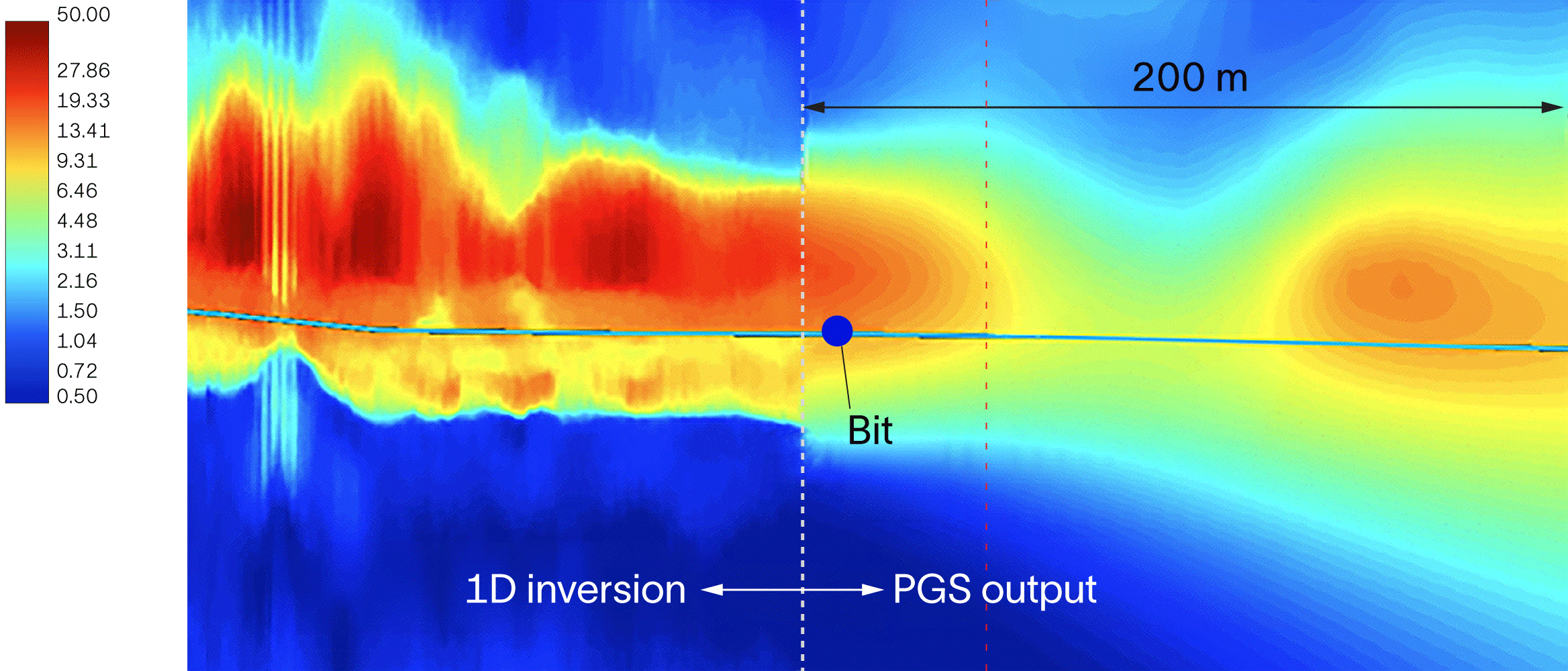
In the horizontal pilot well, the MDAR platform enabled continuous mapping of both upper and lower reservoir boundaries with reduced inversion artifacts and higher confidence in distance-to-boundary interpretations. The result was clearer identification of the OWC and more reliable inputs to existing 3D reservoir models for planning subsequent wells. Horizontal look-ahead results indicated a qualitative reservoir exit approximately 17 m ahead of the bit and provided a high-confidence quantitative interpretation about 13 m ahead, corresponding to roughly 130 min of decision support time under slowed drilling conditions. Integration of MDAR measurements with seismic data enabled looking up to 200 m ahead, with results validated by look-around inversions once the interval was drilled.
The service enabled timely reactions while geosteering, lowered drilling risk, improved well trajectory smoothness, and strengthened real-time geostopping capability. The high-confidence resistivity volumes generated supported timely geological model updates and field development decisions. A key lesson learned was that combining MDAR hardware with seismic-based digital solutions can extend predictive interpretation up to 200 m ahead of the bit, materially improving proactive geosteering in complex reservoirs.