Expedite processing and interpretation up to 10× faster than conventional methods.
Unravelling Sharjah thrust structures with far-field sonic imaging and borehole images for carbonate reservoir delineation
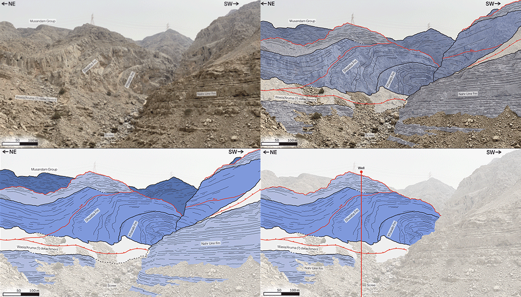
In an onshore Sharjah field with poor surface seismic quality and complex thrust tectonics, SLB integrated far-field sonic imaging with azimuthal sensors and borehole image data—supplemented by cased hole pulsed neutron logs, mud logs, production logging tool (PLT) data, and offset vertical seismic profile (VSP) data—to independently resolve the dip and azimuth of key interfaces and fractures. This near wellbore structural model reduced uncertainty around stacked imbricated thrust sheets and guided well placement and stimulation decisions across three wells, including a sidetrack.
The operation aimed to resolve key subsurface uncertainties in a structurally complex, thrust-faulted carbonate setting where poor seismic quality made reservoir-seal geometry and fault mapping difficult. Additional challenges included the inability to run openhole logs in Well 2, requiring alternative cased hole diagnostics, and the need to characterize fracture controlled permeability across the Lower Cretaceous Thamama carbonates. To address this, SLB deployed an integrated approach combining far-field sonic imaging (with a depth of investigation of up to 65 m), high resolution borehole images, cased hole pulsed neutron spectroscopy, mud gas and PLT data, and offset VSP data in the sidetrack. This multimodal workflow provided both near wellbore detail and extended structural reach, enabling construction of a reliable 3D structural and fracture model across all wells and supporting optimized planning for stimulation and testing.
The integrated dataset significantly reduced structural ambiguity by confirming the geometry of stacked imbricated thrust sheets, correlating image log features with far-field sonic reflections up to 65 m from the wellbore. In Well 2, cased hole sonic imaging successfully mapped the top of the Shuaiba Formation (approximately 40° dip and 115° azimuth) with a lateral reach approximately 28 m, preserving structural insight despite openhole data loss. The sidetrack offset VSP validated approximately 67 m fault displacement, strengthening confidence in the geological model. Fracture characterization across the Shuaiba, Kharaib, and Lekhwair formations benefited from combined image logs, anisotropy, resistivity separation, and sonic fracture responses, enabling targeted acid treatment zone selection prior to a drillstem test (DST). This reduced operational risk, limited unnecessary stimulation, and ensured a more efficient and productive completion strategy. Overall, the customer gained a clearer structural picture, higher confidence reservoir interpretation, and a scalable workflow for future wells in the Sharjah thrust belt.