OnWave
Autonomous logging platform
Ultraefficient, low-risk formation evaluation deployed without wireline.
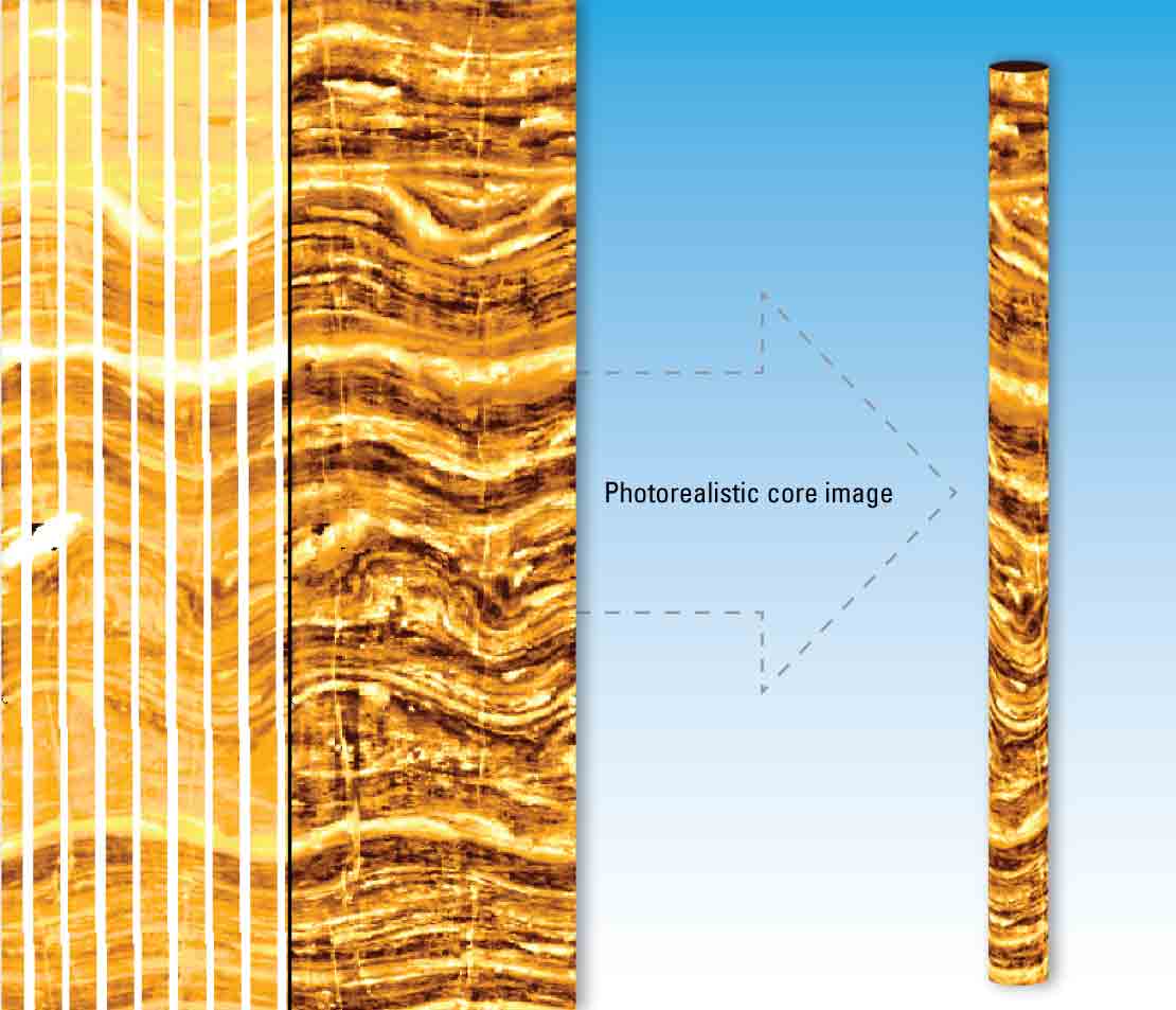
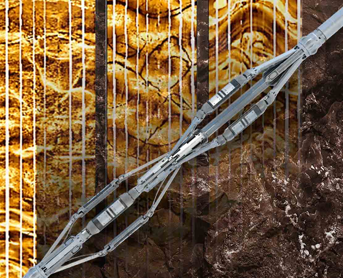
Quanta Geo photorealistic reservoir geology service redefines imaging in oil-based mud (OBM) to provide highly detailed, core-like microresistivity images that truly visually represent formation geology.
Now available in a 5-in version for accessing slim boreholes down to 5 7/8-in diameter, the service's innovative electronic and mechanical design applies simplified measurement physics to deliver superb resolution, accurate dip measurement, and nearly total circumferential coverage. Facies and other sedimentological and structural features can be identified and correlated with precision and confidence that were previously possible only from core.
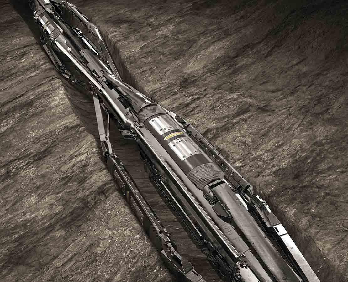
The new slim version of Quanta Geo photorealistic reservoir geology service uses the same 4.5-in sonde as the original tool, with the analog application-specific integrated circuit (ASIC) miniaturized and the pads, arms, and bow springs reengineered to keep the tool's OD to 5 in, enabling it to operate in hole sizes as small as 5 7/8 in. The 5-in Quanta Geo service provides the same high resolution:
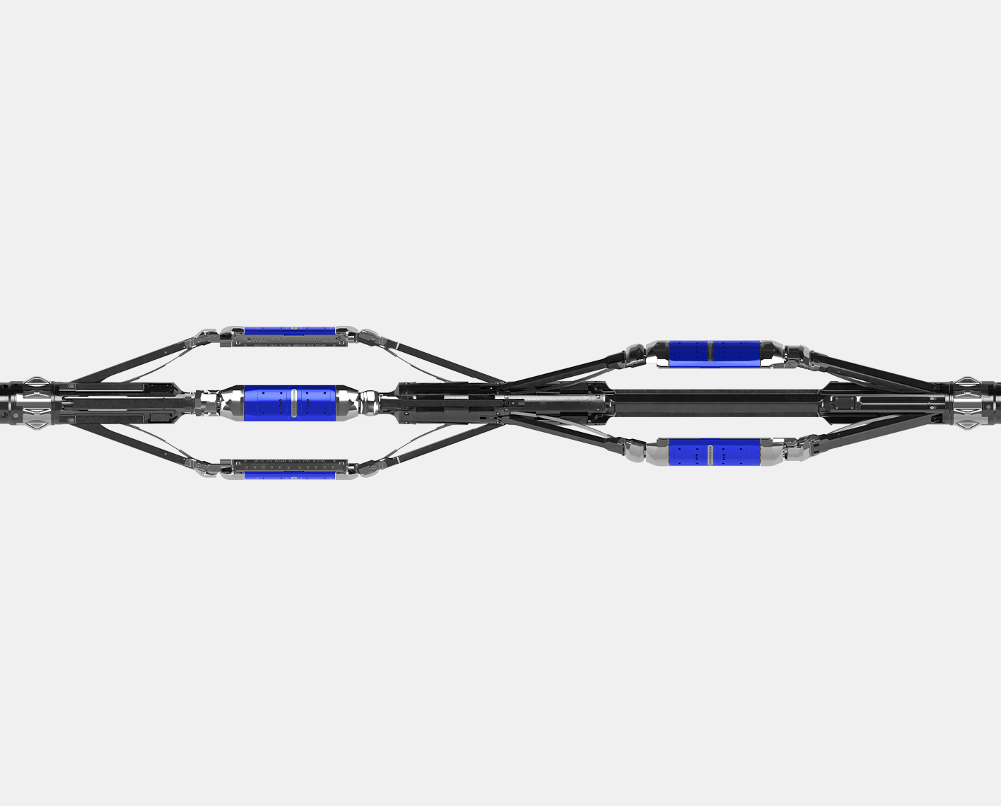
Because Quanta Geo service's dual articulated arms independently apply the eight imaging pads with a total of 192 microelectrode "buttons," both the up and down passes can be logged. Downlogging reduces the frequency and severity of stick/slip events and their effects on image quality while efficiently providing comprehensive information early in the logging program to save rig time and additional runs. This innovative tool design also minimizes inconsistent pad application in inclined wells and boreholes with wall irregularities.
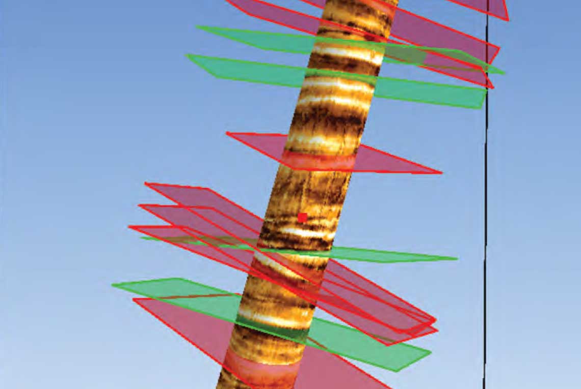
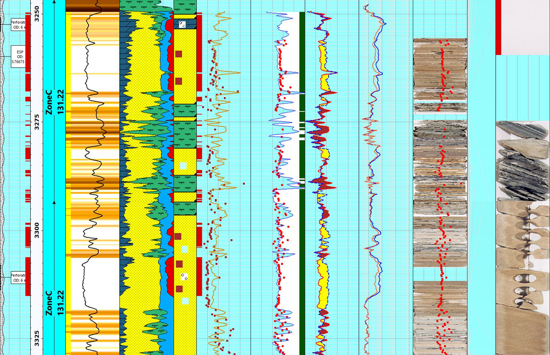
Quanta Geo service's high-resolution geological images accurately position 85 sidewall cores from the thinly laminated reservoir and describe the natural fracture system.
Download case studyQuanta Geo photorealistic reservoir geology service images the entire dynamic range of a well's formation resistivity and measures dip in OBM, typically while downlogging. From these high-resolution measurements, you can visualize sedimentary features and determine dip with precision and confidence that were previously only possible with core.
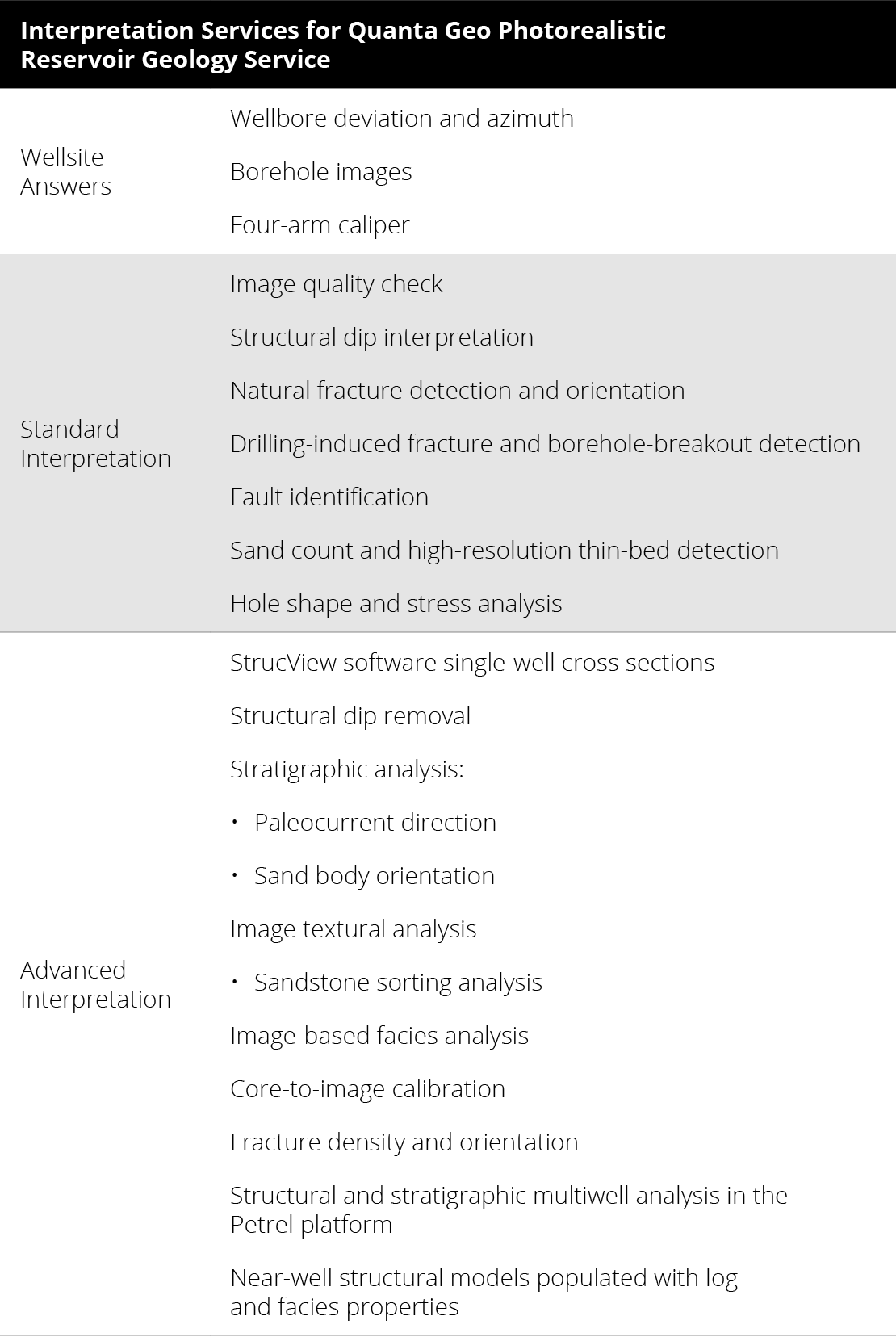
Beyond the wellsite answers listed for basic structural and sedimentary understanding, integrated interpretation employs advanced workflows, the multidisciplinary expertise of our interpretation geoscientists and engineers working with you as needed, and the application of software to maximize the value of your logging data. Visualization and interpretation are fully powered by the full suite of apps and workflows in the Techlog wellbore software platform. The geological answers extracted from Quanta Geo service's images are reservoir model ready for direct use in the Petrel E&P software platform. The result is the fullest possible understanding of structural and stratigraphic features, including complex faults, folds, porosity distributions, and net sand counts.
Reimagine energy performance and improve decision making with connected, intelligent, and autonomous solutions.
Learn more