Unlock basin geometry insights with our multiclient datasets—produced using hybrid, self-supervised machine learning 3D projection from 2D seismic data.
From 2D to 3D: advanced machine learning enables rapid exploration on the Alaska North Slope
ExploreCube™ rapid frontier intelligence, a multi-input, self-supervised deep learning workflow was used to turn reprocessed 2D seismic data into a seamless pseudo-3D seismic volume for Alaska’s Shaviovik region. By combining modern reprocessing, structural guidance, and multidirectional learning, this method preserved the seismic character and filled the spatial gaps found in 2D data, across more than 4,200 km². The resulting dataset made it easier to extract seismic attributes and identify key stratigraphic and structural features compared to using 2D lines alone.
Exploration on Alaska’s North Slope relies heavily on legacy 2D seismic data acquired and processed over multiple vintages resulting in inconsistencies in timing, phase, and amplitude at line intersections, particularly in structurally complex areas such as the Prudhoe Uplands-Shaviovik area.
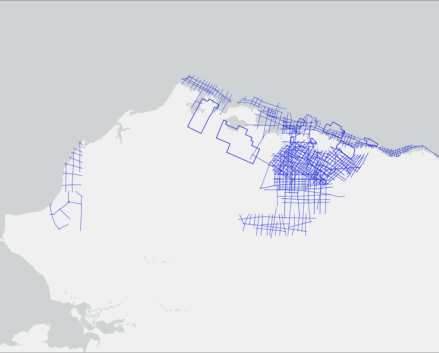
The legacy 2D data available for the Shaviovik area, acquired in 1992–1994 with vibroseis sources, included 31 lines covering approximately 13,000 miles. Because these lines were processed at different times using different methods, mismatches appeared at line intersections.
A pseudo-3D seismic workflow was applied, beginning with preconditioning and crossline alignment of input 2D seismic vintages, optimizing kinematic, amplitude, and phase consistency across the dataset.
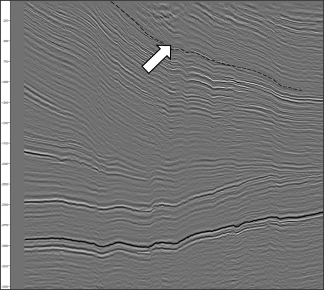
In 2020, the data were reprocessed using modern techniques to achieve consistent wavelets and timing, improve image quality, reduce noise, remove multiples, and stabilize the wavelet over time. Event timing and phase were mostly consistent at intersections, though minor timing misalignments remained, —which is typical for 2D data.
The lines had two main orientations: dip and strike. A final correction was applied to the strike lines to fine-tune alignment, typically by no more than 10 meters. Once aligned, the data were ready for pseudo-3D reconstruction.
Reference models were created using structural information and features from the 2D seismic data. Both the original data and available interpretations (manual or automatic) were combined to build prior knowledge for the self-supervised learning process.
Training and projection occurred in two steps along different directions. First, the model was trained in one direction (inline), combining structural and feature information to estimate likely seismic traces. Next, it was trained in the orthogonal direction (crossline), using the results from the first step along with the original 2D data. This produced a seamless and fully integrated pseudo-3D seismic volume.
Application of the pseudo3D reconstruction workflow enabled fast-track exploration across the Prudhoe Uplands–Shaviovik area and resulted in the generation of the Prudhoe Uplands-Shaviovik ExploreCube intelligence volume. By applying advanced signal processing algorithms to the reprocessed 2D seismic lines, we generated pseudo-3D seismic volumes that spatially interpolate data across more than 4,200 km². This methodology leveraged modern seismic processing techniques and robust multidimensional input architectures to reconstruct volumetric subsurface representations. The result is a high-fidelity pseudo-3D dataset that significantly enhances lateral continuity and imaging resolution, delivering a level of subsurface clarity previously unattainable through conventional 2D interpretation approaches.
This high-dimensional, AI-driven framework facilitates advanced 3D seismic interpretation workflows on pseudo-3D datasets derived from 2D input. Leveraging deep learning and machine learning algorithms, the workflow supports multi-attribute extraction, automated horizon detection, and probabilistic fault segmentation, delivering augmented interpretation capabilities traditionally restricted to full 3D seismic volumes.
This approach has enabled accelerated exploration workflows such as rapid prospectivity assessment and high-resolution block ranking, optimizing ranking criteria and risk evaluation for lease sale opportunities. By overcoming the spatial discontinuity and interpretive limitations inherent in traditional 2D seismic, this technique allows integration of enhanced 2D data into the 3D interpretation domain, reducing cycle times and maximizing asset evaluation in data-limited environments.