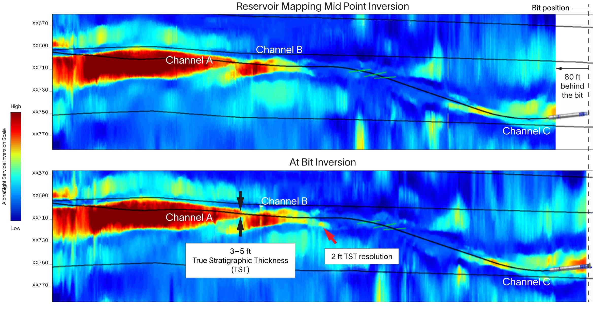
Innovative 3D multi-depth reservoir mapping and horizontal look-ahead-while-drilling service minimizes time from acquisition to geosteering decision

minus
Offshore

While drilling an offshore lateral targeting challenging channel sands, the AlphaSight™ 3D multi-depth reservoir mapping and horizontal look-ahead-while-drilling service provided a continuous suite of look-around and look-ahead resistivity data, enabling identification of pinchouts and structural heterogeneities up to 70 ft ahead of the bit for the operator. This innovative approach shortened decision time, improved wellbore placement across multiple reservoir units, and enhanced reservoir exposure.

A major operator sought to map the reservoir of a mature offshore clastic field with complex, heterogeneous, and meandering channel sands to improve geosteering and optimize wellbore placement while reducing risk and boosting production potential.

The operator integrated the AlphaSight service into the RSS in the BHA, using a modular sensor array to tailor detection depth while minimizing bit offset. The service’s uniquely collocated triaxial antennas enabled true 3D resistivity mapping, capturing the full set of directional measurements while greatly enhancing look-ahead inversion sensitivity. The AlphaSight service successfully identified pinchout features and structural heterogeneities up to 70 ft ahead of the bit and provided proactive well steering across both target stratigraphic units in a single run—reducing sidetrack risk and preventing unnecessary drilling. With an enhanced signal-to-noise ratio and resolved thin-bed features near the wellbore, the resulting data quality translated into clearer reservoir interpretation and increased confidence in reservoir placement.  As a result, the operator reduced NPT and benefitted from more strategic completion decisions, with fewer runs and better reservoir exposure.

Chart showing full overview of the at-bit and reservoir mapping midpoint using AlphaSight service.
Full overview of the at-bit and reservoir mapping midpoint AlphaSight service inversions along the entire geosteered section. The at-bit inversion, with earlier detection than the reservoir mapping midpoint inversion, was used as the primary geosteering inversion, reducing steering decision reaction time while still enabling mapping of the channel pinchout.
Products Used