Real-time uncertainty analysis enhances geosteering confidence

minus

The SLB ensemble-based deterministic inversion (DPI) methodology provided real-time uncertainty quantification for subsurface resistivity mapping, enabling safer and more accurate geosteering. By delivering confidence intervals for key layer properties, the solution reduced operational risks and improved decision-making efficiency. This innovative approach allowed operators to optimize well placement while minimizing computational demands.

Operators faced significant challenges in accurately assessing subsurface uncertainty during geosteering operations, particularly in poorly constrained regions farther from the wellbore. While modern LWD EM tools provided high-resolution resistivity data, the deterministic inversion process introduced substantial uncertainty due to factors such as measurement noise, incomplete data, and the inherent nonuniqueness of geophysical models.

Traditional 1D and 2D deterministic workflows often underestimated this uncertainty, relying on limited initial models and failing to provide a comprehensive understanding of confidence intervals. Stochastic workflows, while capable of quantifying uncertainty, were computationally intensive and unsuitable for real-time operations. As a result, operators were forced to make critical well placement decisions with incomplete information, increasing operational risks and potentially compromising reservoir exposure. The customer sought a solution that could deliver real-time, actionable insights into subsurface uncertainty to improve geosteering accuracy and reduce risks.

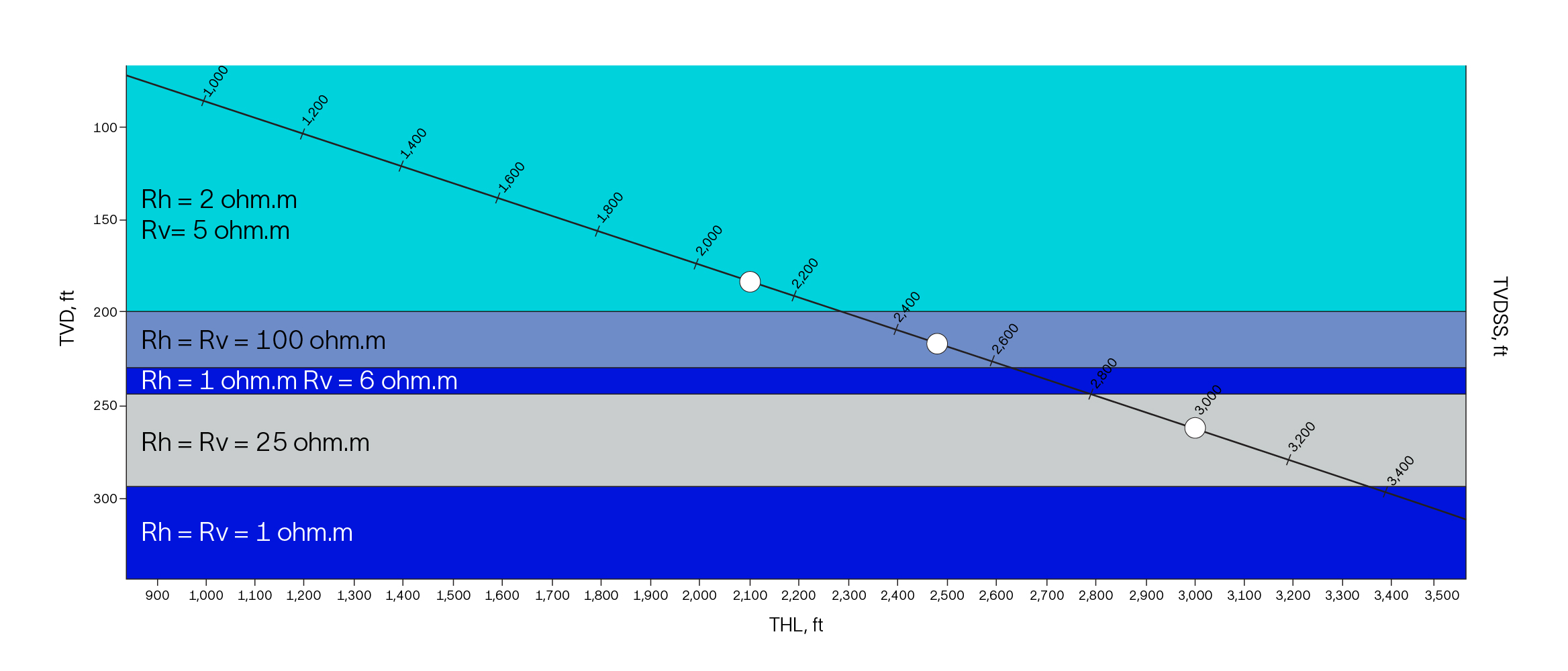
SLB implemented its ensemble-based DPI methodology to address the customer’s challenges. This innovative approach efficiently quantified uncertainty by generating confidence intervals for key layer properties, such as resistivity, thickness, anisotropy, and boundary positions. Unlike traditional deterministic workflows, the ensemble-based method used posterior model sampling to capture the full range of possible solutions, requiring fewer forward simulations than brute-force stochastic methods.

At selected measured depths, the methodology provided cumulative probability percentiles (e.g., p5, p50, p95) for each layer property, enabling decision makers to directly assess risks in critical intervals. The results confirmed known physical expectations, such as higher uncertainty in vertical resistivity (Rv) compared to horizontal resistivity (Rh) and greater uncertainty in layers farther from the tool. These insights allowed operators and petrophysicists to identify well-constrained boundaries and areas requiring additional caution or contingency planning.

The solution also delivered real-time or near-real-time uncertainty bounds during both synthetic and field-case studies, supporting safer and more accurate geosteering. By integrating robust uncertainty analysis into real-time DPI workflows, the customer achieved greater confidence in well placement decisions, optimized reservoir exposure, and reduced operational risks.