Premium
Subsurface imaging
High fidelity imaging for complex environments

Unlock powerful insights beneath the surface and drive confident decisions
Geosolutions blends industry-leading expertise, advanced technology, and a dedication to service quality to deliver the highest clarity possible in seismic and reservoir imaging. Our teams harness the latest tools, including AI-driven workflows and innovative solutions, to consistently provide actionable insights for your most challenging exploration and production projects.
With a comprehensive portfolio spanning survey design, advanced imaging algorithms, and quantitative interpretation, we empower you to make informed decisions with confidence and maximize resource potential. Partner with us to see how experience, technology, and next-generation AI can help address your subsurface challenges.
-
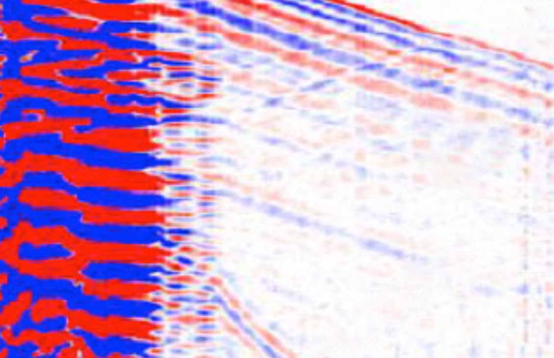
Ocean bottom node (OBN) seismic
Empowering exploration with innovation in seismic imagingRevolutionize offshore exploration with high-quality seismic insights for complex environments.
-
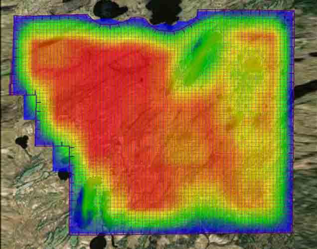
Seismic Survey Design & Modeling
Tailored solutions to your geophysical challenges and objectivesAddress acquisition, data processing, seismic interpretation, and drilling challenges.
-
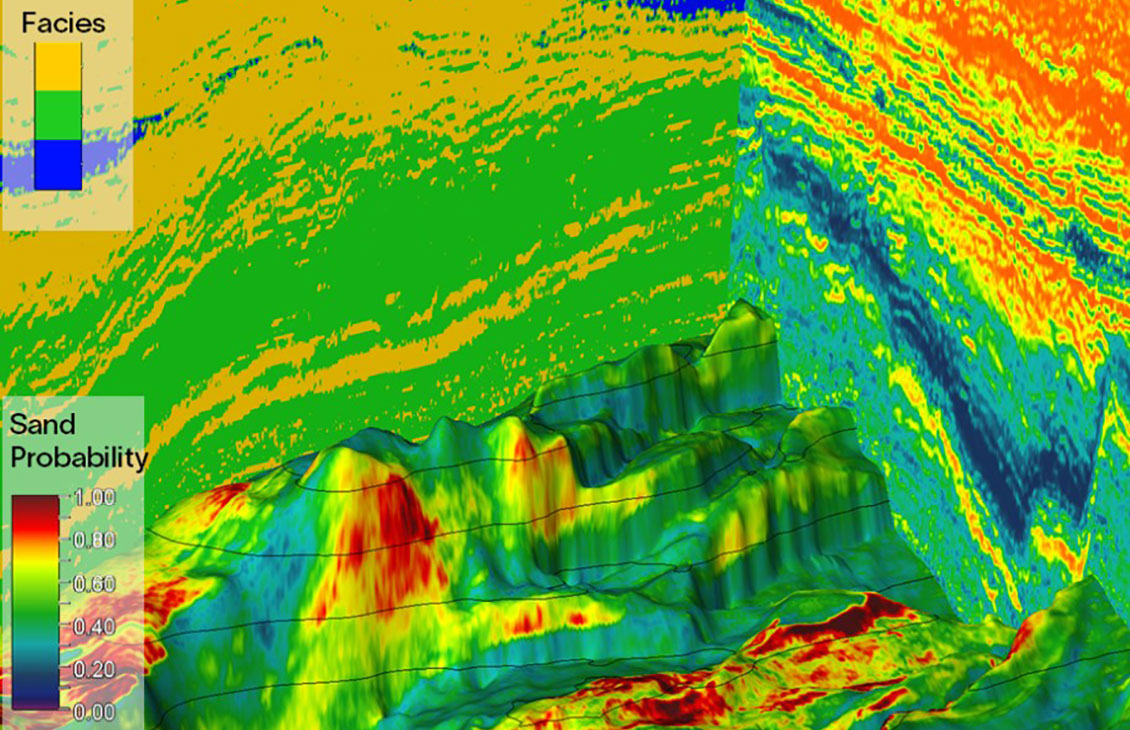
Seismic quantitative interpretation
Subsurface modeling for optimized operationsUsing the most advanced tools available, we provide consistency between all models and acquisition data.
-
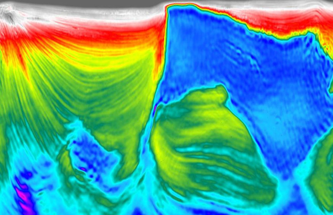
Full-Waveform Inversion
High-resolution velocity modelsDerive high-resolution velocity and anisotropy models from seismic data using a two-way wave equation.
-
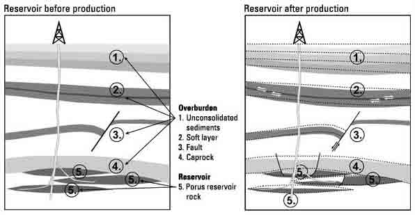
Time-Lapse 4D Analysis and Interpretation
Accurate, repeatable, actionable reservoir monitoringMonitor changes in reservoir properties by integrating 4D seismic into the reservoir model.