Well Radar
Ranging and interception services
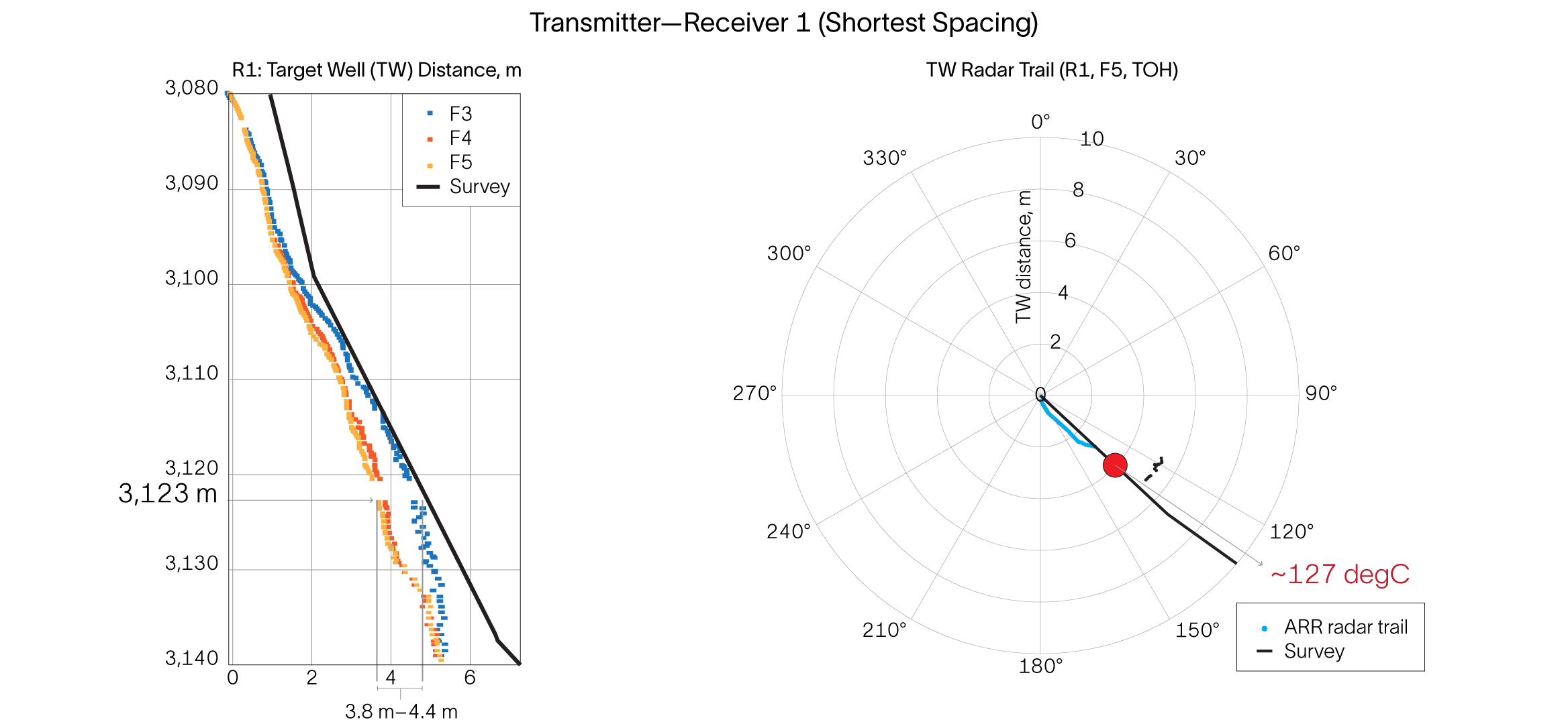
Well Radar services combines technologies and expertise in drilling to surpass traditional ranging methods.