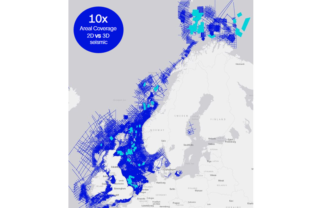
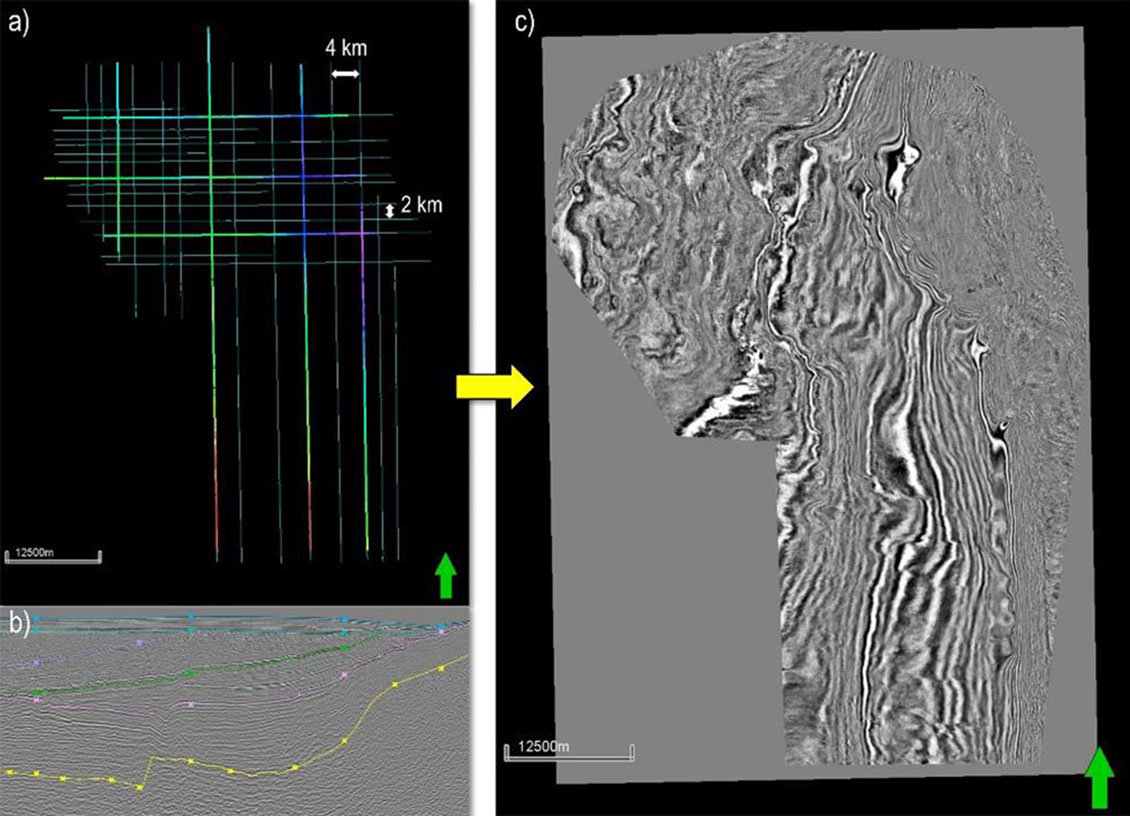
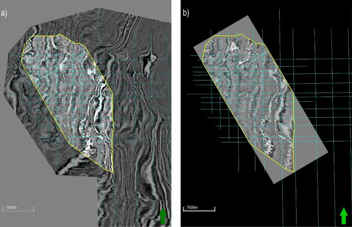
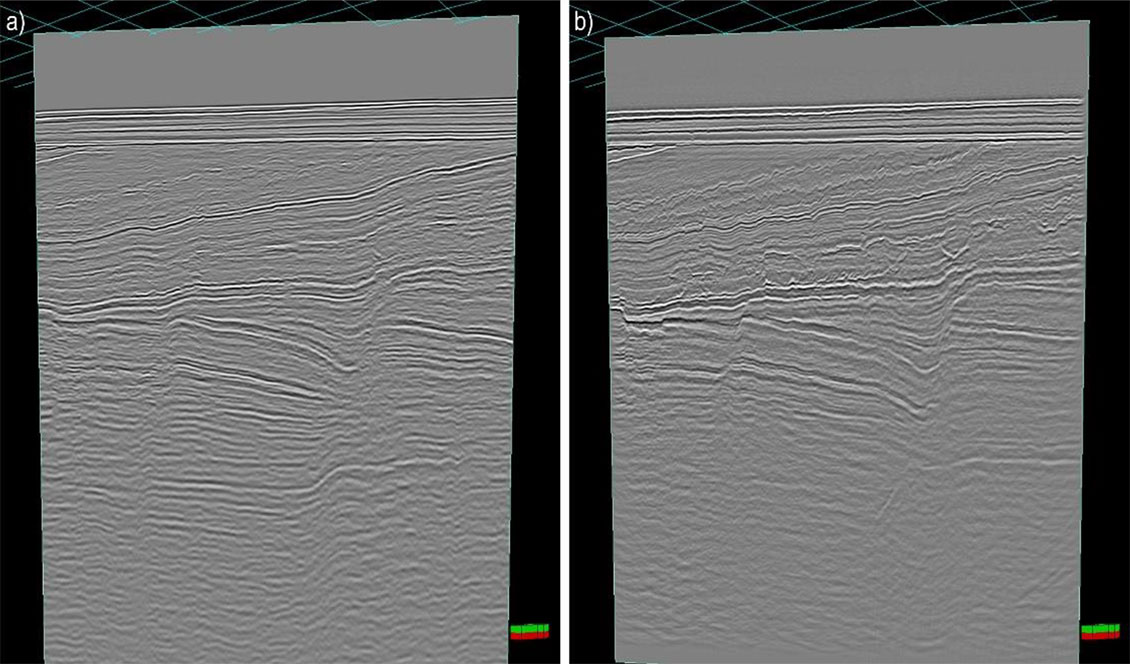
Unlock basin geometry insights with our multiclient datasets—produced using hybrid, self-supervised machine learning 3D projection from 2D seismic data.
From sparse 2D to striking 3D: revolutionizing seismic interpretation in the North Sea
ExploreCube™ rapid frontier intelligence was used for reconstruction over a pilot study area in the North Sea, successfully transforming a sparse legacy 2D seismic dataset, comprising just 29 lines over 4,000 km², into a coherent and high-resolution pseudo-3D volume. Using a deep learning-assisted workflow, the team achieved over 50% time savings in horizon interpretation compared to manual methods.
The resulting pseudo-3D volume preserved the integrity of the original 2D lines while enabling extraction of 3D volumetric seismic attributes. Validation against a collocated true 3D seismic volume confirmed strong visual and structural resemblance.
Unlocking 3D insights from sparse 2D data in the North Sea
This project focused on a legacy 2D seismic survey in the North Sea, covering approximately 4,000 km² with just 29 sparsely distributed 2D lines. The limited data density posed a significant challenge for regional geological interpretation and volumetric analysis, especially in areas where full 3D seismic coverage was unavailable or cost prohibitive.
To address this, we applied ExploreCube intelligence—a deep learning (DL) structural-guided reconstruction scheme designed to convert multi-vintage 2D seismic image lines into a coherent pseudo-3D seismic volume. This approach enables geoscientists to extract meaningful and regional insights from sparse datasets, bridging the gap between 2D and 3D seismic interpretation.
The workflow consists of three key steps:
- DL-assisted seismic horizon interpretation, in which we interpret seismic horizons to serve as structural guidance during the interpolation steps.
- Label generation via deterministic interpolation, in which we build two 3D proxy volumes, one as the input to the DL model, and the other as pseudo-targets to augment the DL training.
- Self-supervised two-stage DL-based reconstruction, which generates the final 2D-to-3D image conversion result.
50% faster interpretation with ExploreCube intelligence
The ExploreCube intelligence workflow was used to transform a legacy 2D seismic survey from the North Sea, comprising 29 2D lines covering an area of 4,000 km² (Figure 1a). These 2D lines represent less than 0.01% of the data compared to the generated pseudo-3D volume at 25 m × 25 m trace spacing.
As structural guidance, we manually interpreted six horizons on a subset of 2D lines to train a DL model, which was then used to predict horizons across the remaining lines (Figure 1b). This DL-assisted workflow resulted in time savings of over 50%, compared to manual interpretation.
Following the deterministic and DL interpolation steps, we obtained the final pseudo-3D volume (Figure 1c). This volume provides a realistic and plausible 3D projection of the 2D lines while preserving the ground truth at the original line locations. It also enables the extraction of seismic attributes that would not be possible using 2D lines alone.
The pseudo-3D volume has been further validated against a collocated true 3D seismic volume. Visualizations from both vertical (Figure 2) and horizontal (Figure 3) slices confirm that the pseudo-3D volume closely resembles the true 3D volume.
By combining deep learning, deterministic operators, and geological expertise, ExploreCube intelligence was able to deliver superior 2D-to-3D seismic conversion quality. Seismic attributes, derived from the ExploreCube intelligence 3D seismic volume, aid in the delineation of potential areas of interest in frontier environments. These insights are invaluable for planning and defining future 3D seismic programs, ensuring a more targeted and cost-effective exploration strategy.