Full-Waveform Inversion
High-resolution velocity models for a range of E&P scenarios and geological settings
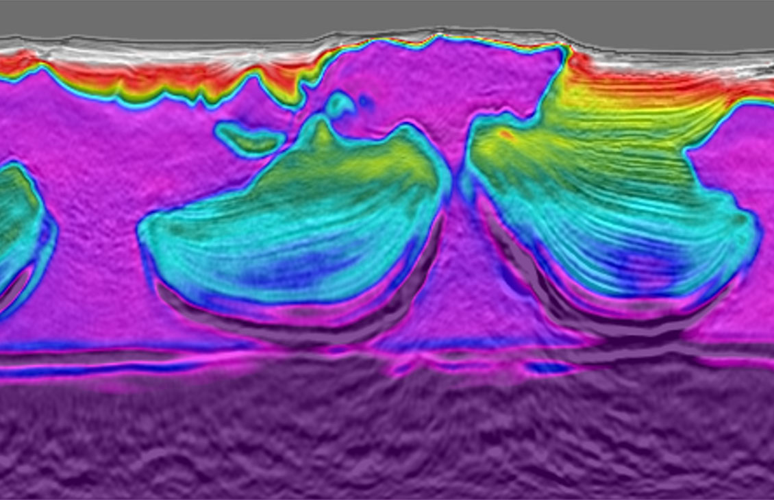
FWI uses a two-way wave equation to derive high-resolution velocity and anisotropy models from seismic data.


Egypt’s announcement of the Red Sea 2025 Bid Round marked a major milestone in its energy strategy, unlocking new opportunities across highly prospective frontier basins.
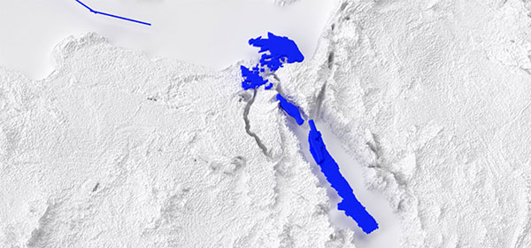
SLB, in partnership with TGS, are offering an extensive seismic data library, including high-quality 2D and 3D datasets, operators now have unprecedented access to evaluate the region’s hydrocarbon potential. This availability empowers more informed exploration decisions within a newly accessible landscape.
Exploration activities in the Red Sea have revealed promising hydrocarbons indications. In recent years, several oil and gas companies have been granted exploration licenses and conducted seismic surveys in offshore blocks. While exploration work continues and much remains to be discovered, initial assessments and geological studies indicate the presence of significant resources in the basin.
Salt deposits in the subsurface present an imaging challenge. To address this, the 2018 survey design and processing algorithms, were specifically optimized, resulting greater signal at depth and a significant improvement in sub-salt imaging.
The long-offset 2D seismic survey—utilizing 12km offsets and 14 second record lengths—enhanced our understanding of the deep section from improved seismic imaging and a study.
Following the processing of the initial fast-track survey, a post-stack time migration (PSTM) survey was fully processed applying modern algorithms to tackle multiple energy and attenuate noise. The seismic image was further improved by depth processing, firstly to produce a post-stack depth migration (PSDM) depth stack and then beyond that reverse time-migration (RTM) was used to deliver the final survey fit, optimized regional interpretation, basin analysis, and modeling.
Datasets are offered by SLB and TGS in partnership.


The Egyptian Red Sea presents a highly complex subsurface environment, from the rugose water bottom, complex layered evaporites, and massive salt bodies to the complex pre-salt section. Clear and accurate imaging of these structures requires high-quality 3D seismic imaging. However, existing legacy 3D imaging in the Red Sea region has suffered from poor imaging in the pre-salt section and has limited bandwidth.
To address these challenges, we utilized the latest geophysical technologies and experience to reprocess the available seismic data. Our reprocessed and newly imaged seismic data delivers new insights into the exploration potential of the Egyptian Red Sea.
Advanced geophysical techniques, such as adaptive de-ghosting, have boosted the frequency content for both the low and high end of the spectra. Improved salt modeling techniques have not only enhanced the imaging of the deeper stratigraphic intervals, but have also provided clearer definition of the salt morphology , and a more reliable base salt is image. The result is a marked improvement in overall pre-salt imaging, definition of faults, and a significantly higher signal-to-noise ratio.
Datasets are offered by SLB and TGS in partnership.


Although located near the well-explored Gulf of Suez region, the Red Sea basin remains a geologically complex and underexplored region. Earlier exploration efforts yielded only limited success, but nevertheless gradually advanced basin knowledge and affirmed the presence of an active petroleum system. This was demonstrated by numerous oil and gas shows encountered in the drilling of 14 wells within the basin. The basin’s prospectivity was also supported by the favorable results of a 2023 piston core survey conducted in 2023 by a major operator.
In 2022, a long-offset, dual-source NAZ seismic survey was acquired and subsequently processed in 2023 using state-of-the-art multisource broadband eFWI workflows, along with shipborne high-resolution gravity and magnetic surveys. These efforts have provided far more detailed imaging of the Red Sea subsurface, enhancing our ability to identify and de-risk hydrocarbon prospects in the basin.
Datasets are offered by SLB and TGS in partnership.


Improve regional understanding and reduce drilling risks with access to high resolution seismic datasets
Contact us to learn more