Energy Insights Gateway

The Energy Insights Gateway will enable you to discover and evaluate subsurface opportunities to accelerate your path to achieving net-zero emissions as governments, agencies, and industries across the world increase their focus on sustainability. Our multidisciplinary, integrated digital platform leverages more than 50 years of super basin expertise from SLB to transform raw subsurface data into action-enabled insights. You will access a fit-for-purpose, tiered offering model including data, software, consulting, services, and end-to-end solutions, enabling you to de-risk CO2 and hydrogen geological storage, and improve prospect evaluation for geothermal, lithium and more. We will enable you to move fast from vision to decision.
-
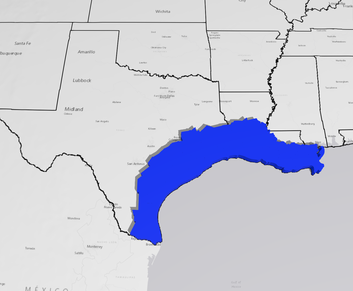
US Gulf Coast
20,000+ sq. mi. 3D of seismic data, multiple CCS assessment packages, digitized petrophysical data etc.Our GOM TZ package includes over 20,000 sq. mi. 3D of seismic data, multiple CCS assessment packages, digitized petrophysical data etc.
-
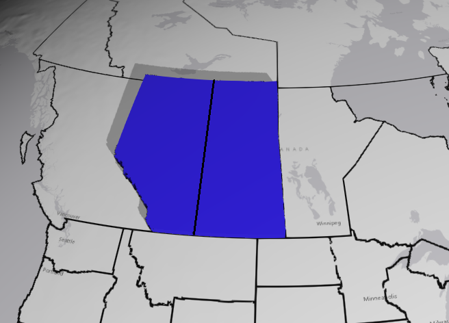
Canada
11,000+ sq. km. of 3D seismic, reservoir products, geological models, newly reimaged 3D volumes and ongoing new/ alternative energy projects.Our Canada package includes over 11,000+ sq. km. of 3D seismic, including reservoir products, geological models, newly reimaged mega merged 3D volumes and ongoing new/ alternative energy projects.
-
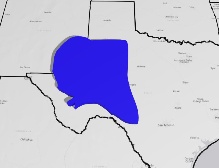
Permian Basin
13,000+ sq. mi. of 3D seismic, including reservoir products, geological models, and many enhanced oil recovery/ new energy projects.Our Permian package includes over 13,000+ sq. mi. of 3D seismic, including reservoir products, geological models, and many enhanced oil recovery/ new energy projects.
-

South Texas
4,000+ sq. mi. of 3D seismic, reservoir products, AI/ML horizon and fault interpretations and ongoing geothermal screening assessments.Our South Texas package includes over 4,000+ sq. mi. of 3D seismic, including reservoir products, AI/ML horizon and fault interpretations and ongoing geothermal screening assessments.
Living Digital Webinar - Unlocking Secrets: Revealing the potential for carbon storage along the Texas gulf coast
Large-scale deployment of carbon capture and storage (CCS) will be required if countries such as the United States are to achieve their climate targets by 2030. The Texas Gulf Coast is a very attractive region for carbon sequestration (CS), with high storage capacity in the Frio, Lower Miocene, and Middle-Upper Miocene.
Two CCS assessment projects have been completed in Galveston Bay and Corpus Christi Bay to support the recent 2023 Texas State CS Lease Sale. The main objective of these studies was to evaluate the CS potential of these blocks. The assessment used SLB multiclient seismic data, publicly available well logs, legacy well data, and surface infrastructure such as CO2 emitters and pipelines. Understanding the integrated nature of CCS projects is essential to accurately characterize the complex geology and successfully derisk the projects. This talk will examine the studies in more detail and explore how these methods can be duplicated elsewhere.