
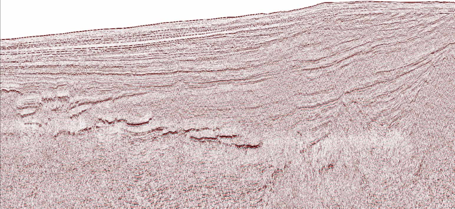
Multiple Attenuation
Extensive portfolio of demultiple algorithms and innovative workflows
Address surface and internal multiples and obtain the optimal solutions for a wide range of scenarios.

WesternGeco, in collaboration with GeoProvider, is undergoing a multiclient reprocessing project extending across the Møre Basin in the Southern Norwegian Sea. The project comprises 13,000 km of 2D seismic data from five legacy surveys, with reprocessing lines in the Awards in Predefined Areas (APA) 2020 and 25th licensing round blocks.
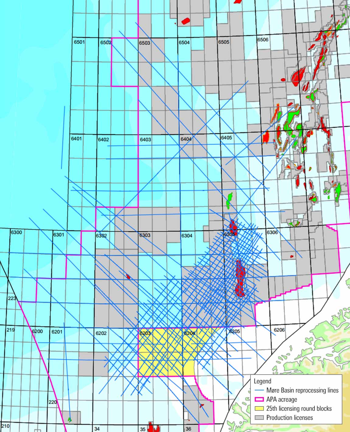
The Palaeocene and Cretaceous reservoir intervals of the Møre Basin present an exciting exploration opportunity west of the existing Jurassic Norwegian Sea play, with confirmed reservoir units and hydrocarbon presence. Cretaceous stratigraphic traps continue to be successfully exploited globally, and many of these features can be observed and mapped on the 2D seismic datasets.
The Møre Basin 2D reprocessing project offers a valuable opportunity for significant image uplift through a modern processing sequence. This includes deterministic inversion of source-and-receiver ghosts; the latest multiple attenuation methods; and experienced, interpretation-led velocity analysis.