Full-Waveform Inversion
High-resolution velocity models for a range of E&P scenarios and geological settings
FWI uses a two-way wave equation to derive high-resolution velocity and anisotropy models from seismic data.

Whether you’re investing in carbon capture and storage (CCS) or looking to revitalize your exploration portfolio, SLB provides the geophysical data and expertise you need to make confident, informed decisions across the UK Continental Shelf (UKCS).
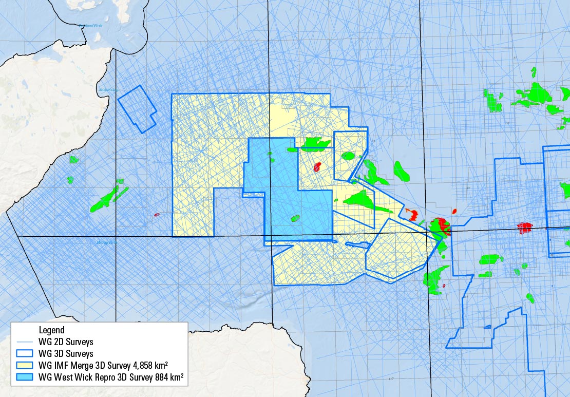
Our extensive multiclient 2D and 3D data library helps you close data gaps, identify optimal 3D survey locations, and access reprocessed data for fit-for-purpose results.
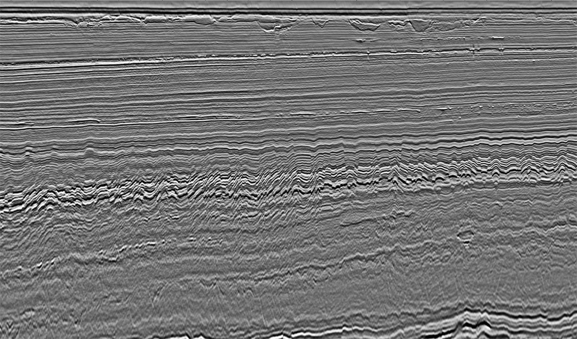
SLB has recently revamped its 2D and 3D database for CCS-related projects across the Southern North Sea and Central North Sea. The seismic data has been reprocessed and re-imaged to deliver a high-resolution product, supporting improved site de-risking for carbon storage. This work applies a comprehensive broadband processing workflow with pre-stack depth migration and full-waveform inversion (FWI) imaging, capturing fine subsurface details with exceptional clarity.
Our processing sequence incorporates adaptive deghosting, advanced demultiple techniques, and FWI-driven velocity model building, utilizing the latest advances in signal processing and earth modeling to maximize imaging accuracy and resolution.


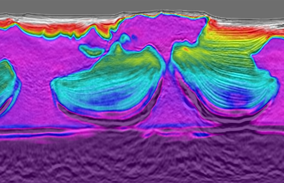
Our advanced reprocessing and imaging techniques deliver significantly clearer seismic images of critical overburden structures, including improved fault definition and seal continuity.
This uplift enhances confidence in assessing top-seal integrity and containment risk, key factors in screening and certifying viable CO₂ storage sites, that may have been previously overlooked.
FWI unlocks high-resolution velocity models without the need for mature starting models, low frequencies, or long offsets.
Our advanced FWI workflows deliver sharper, more reliable seismic images, particularly in the shallow waters of the UK Continental Shelf, where complex overburden geology can obscure critical detail. This enhanced clarity supports more accurate characterization and de-risking of carbon storage sites.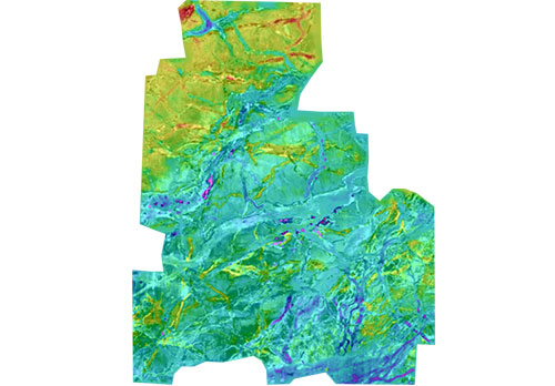
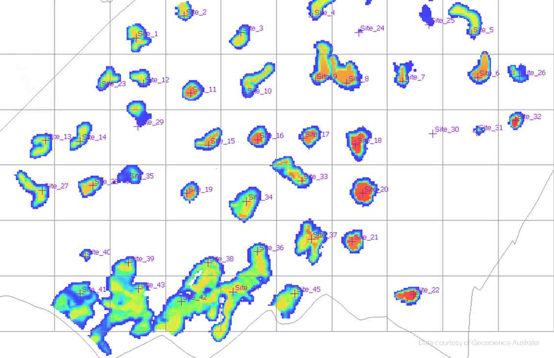
High-resolution overburden details such as fault networks and shallow gas captured by FWI on a shallow depth slice (1000m)


We’ve used ExploreCube™ rapid frontier intelligence to enable the transform regional 2D seismic data, integrated with prior geological information, into a seamless 3D volume. This streamlines interpretation reducing time and effort required for desktop studies. The resulting 3D volume provides a cohesive view of the regional geological framework, enhancing understanding of subsurface structures and supporting more informed carbon storage evaluation and rapid investment decisions.