Azimuthal Anisotropic Analysis
Multicomponent solutions for defining fractured reservoirs
Detect, quantify, and compensate for azimuthal anisotropy to help determine fracture density and orientation.
Published: 09/01/2010

Published: 09/01/2010
Operators in shale plays face significant exploration and delineation challenges that can be addressed using seismic methods. A fundamental challenge is that the seismic velocity of shale tends to be much greater horizontally than vertically. Also, velocities vary azimuthally under the influence of stress and preexisting fractures. Understanding both these anisotropies is important in predicting the location of preexisting natural fractures in the rock and how induced fractures might grow. Delineating sweet spots, mapping rock stiffness vertically and laterally, and identifying drilling hazards such as faults also improve drilling and completion operations.

The relative importance of specific reservoir characteristics varies from shale to shale. For example, the relative importance of pre-existing fractures and lateral variations in stress varies widely. Both are important in this particular shale. Also important is lithology. In each shale, the most porous rocks are those with the highest total organic carbon (TOC). This could be the carbonate facies, the siliceous facies, or the argillaceous facies, depending on the shale. In this pilot study area, the siliceous facies contains most of the porosity. Fortunately, this is also the facies with the greatest stiffness, so this was the interval to be drilled and fractured.
The operator wanted to evaluate shale acreage using a 9-km2 3D seismic grid and logs and production data from two wells. Subsequent drilling during the project provided an additional control point, the analysis of stress from a Sonic Scanner acoustic scanning platform log in the new well. Results of this reservoir characterization study would be used to plan and drill additional wells.

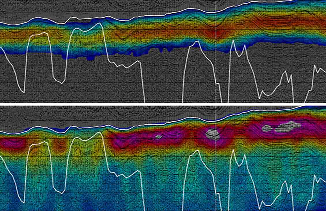
Simultaneous inversion of prestack surface seismic data yields seismic rock properties that can delineate reservoir sweet spots, such as the more siliceous portions of this Mississippian shale.
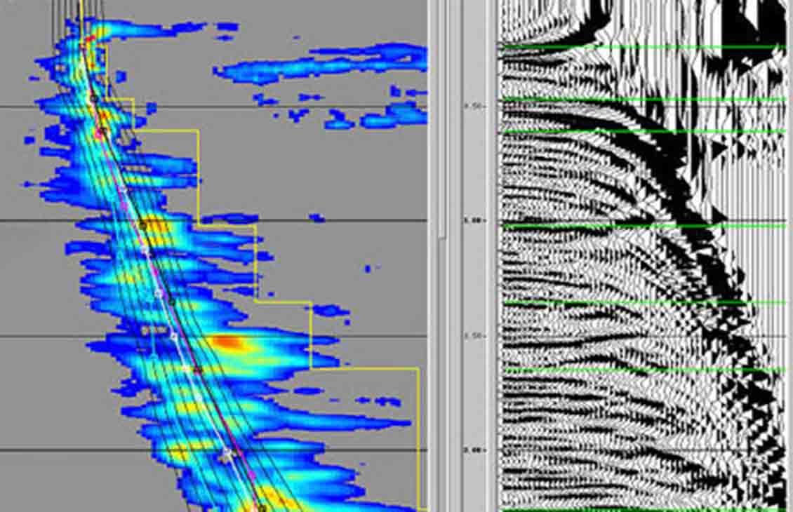
Ant Tracking was performed to enhance identification of planar features indicative of faults. Also, more subtle but operationally important features such as fracture swarms that degrade the seismic image and can be detected by Ant Tracking. This method of enhanced fault delineation reduces the risk of drilling near faults by providing a high-resolution image of fractures and faults, which is better than interpretation that uses only conventional seismic data or fault attributes such as coherence and variance. These reservoir features can divert the energy of a hydraulic fracturing stage and impair production from that stage.
The integration of seismic rock properties and detailed fault delineation provides effective delineation of sweet spots and drilling hazards, improving shale gas profitability. Seismic interpretations were integrated with log data, including Ant Tracking results and data from the Sonic Scanner platform. Together, these provided detailed delineation of fault features, reservoir sweet spots, and stiffness stratigraphy that went well beyond what would be discerned using only conventional analysis of the seismic data.
In this Mississippian shale reservoir, zones with the greatest azimuthal anistropy proved to be more productive, although this result does not necessarily hold true for other shale reservoirs. Using maps and cubes generated through seismic reservoir characterization, the operator was able to improve efficiency by focusing drilling efforts in areas where production would be greater.
As a result of seismic reservoir characterization, the operator realized that potential infill drilling locations were not likely to achieve adequate production in this pilot area. By focusing on high-graded drilling locations, drilling operations were more effective and financial results more positive.
Challenge: Understand anisotropy of shale reservoir and delineate shale reservoir sweet spots, reservoir areas to be avoided, and subtle faults that previously had been overlooked. Optimize drilling and completion in a 9-mi2 pilot area.
Solution: Perform full seismic reservoir characterization, including azimuthal velocity analysis, prestack inversion, and fault image enhancement in a 9-mi2 3D seismic grid, and integration of measurements from three wells.
Results: Achieved more consistently effective completions, optimal drilling locations, and more profitable development of shale reservoirs. Reduced operational risk of diverting into a fault with accurate fault identification.